AFTER THE SPRAY PAINT FADES….
With eight regional offices across the UK, Castle Keep Surveys reflects the ethos of its managing director, Mick Dixon. The company has a policy of recruiting new talent from local colleges and Mick supports his team with an extensive and innovative survey portfolio that is especially well suited to the demands of utility surveys.
An early adopter of drone and SLAM (simultaneous localisation and mapping technology), the company has recently expanded its range of KOREC-supplied equipment, including a Trimble 3D laser scanner, total stations and GNSS, with the addition of Trimble SiteVision. This advanced augmented reality (AR) system allows users to overlay 3D models onto real-world environments with high accuracy, making complex spatial data easier to visualise.
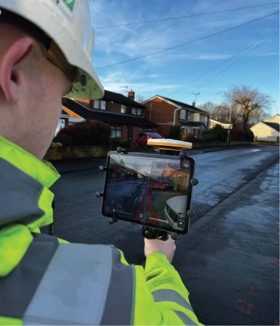
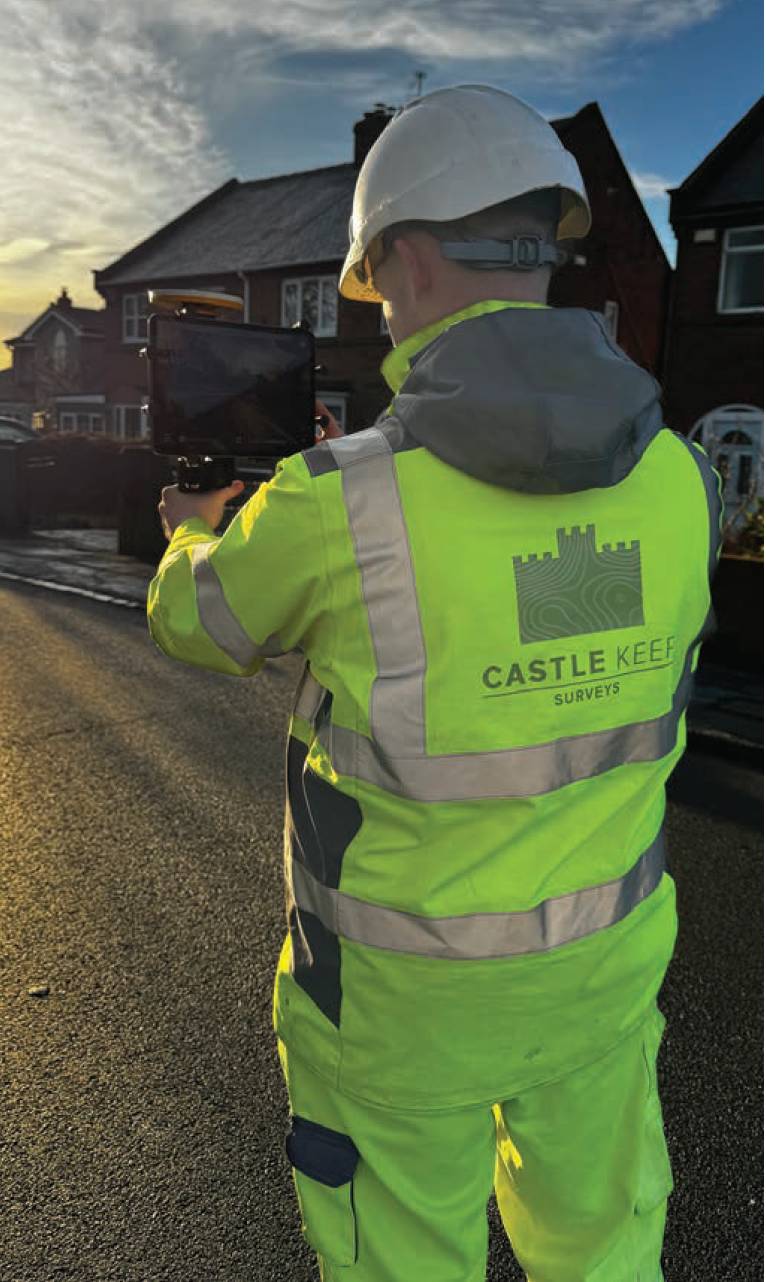
Onsite with the Trimble Site Vision system.
Contracted by Seymour Civil Engineering Contractors for a project on behalf of Northumbrian Water, Castle Keep Surveys was required to undertake a PAS 128 survey to detect, verify and locate underground utilities on a residential street in Sedgefield.
The householders had been experiencing flooding running back into their homes due to drain blockages. This was to be remedied by moving the drains into the street, subject to the findings of the Castle Keep survey work.
Seymour wished to find a better method of being able to view the position of these assets that would eliminate the need for paper maps and spray paint, which could often fade or wash away while still needed.
Following extensive testing by Castle Keep senior surveyor Will Harrison, a SiteVision system was purchased specifically for this project.
Under his guidance, the PAS 128 survey was carried out by two teams over a five-day period using electromagnetic and GPR devices connected to a Trimble R12i GNSS. This data was then processed in n4ce to turn the utility lines into 22mm tubular renditions and create a 3D model.
The model was fitted to OSTN15 and then exported as an IFC file via Trimble Connect (a free cloud-based collaboration platform).
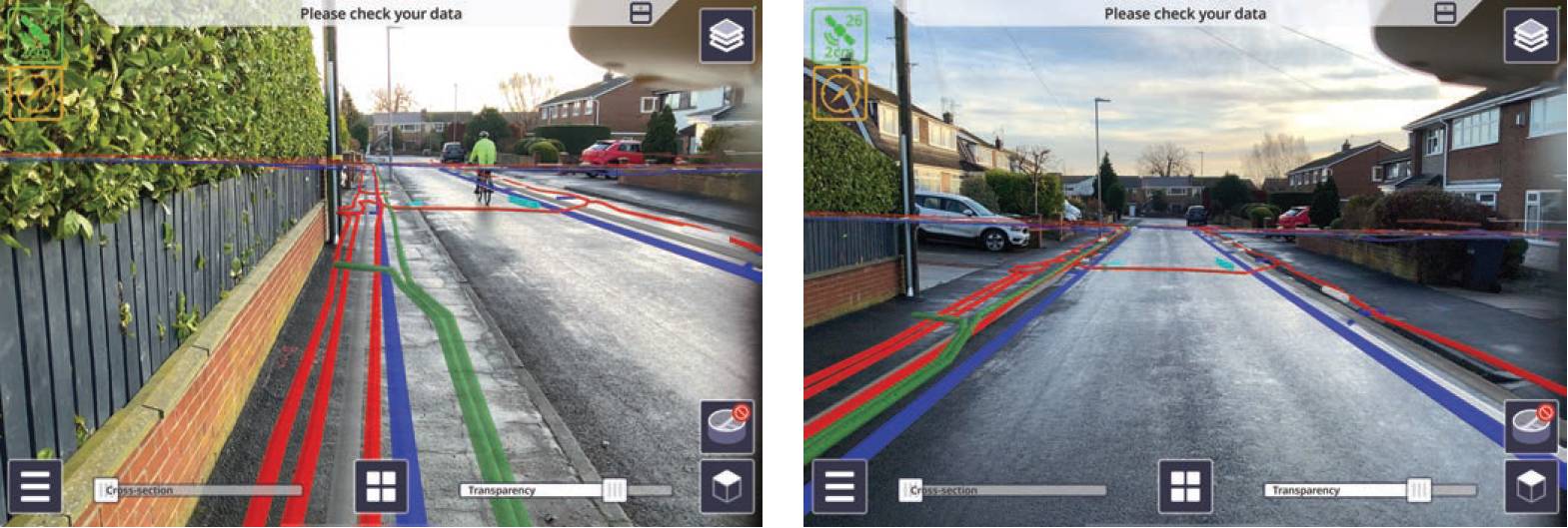
The system shows the relationship of the underground utilities to surrounding walls and buildings.
Geospatial data can now be visualised in real-world environments.
Trimble SiteVision is an advanced AR system designed for visualising geospatial data in real-world environments. The Castle Keep system consists of a handheld tablet that integrates with a low-cost Trimble Catalyst DA2 GNSS receiver for precise positioning.
Users can walk around a site and view 3D models, underground utilities and design plans overlaid on their surroundings, in this case the IFC model, helping them understand spatial relationships and make informed decisions.
Following trials and a brief run-through on how to operate the system, the client is now actively using SiteVision for the faster and more accurate location of the surveyed underground assets.
They were up and running within just five minutes of turning the system on and achieving accuracies of around 30mm, which was more than sufficient for their application and far more accurate than spray paint.
The system is not designed to replace a safe digging method but is another way of reestablishing the previously located utilities to around 30-40 mm accuracy.
Clarifying decision making, the system means that the client can return to site long after the spray paint has faded or washed away.