
Podfather has become a delivery partner of the Construction Logistics and Community Safety Scheme (CLOCS) that requires all stakeholders in construction to take responsibility for health and safety beyond the building site and take ownership of work-related road risks.
Podfather is able to provide valuable input and support to construction companies in their drive to deliver safer, leaner and greener construction logistics. With over 30,000 users, across different sectors, it helps companies plan manage and track their vehicle resources.
Specialising in the development and delivery of solutions that help fleet operators plan and manage their logistics operation, it has over 20 years’ experience of working with operators and construction companies such as Breedon and Tarmac.

BigChange has developed a system to help commercial vehicle drivers avoid unexpected charges and fines associated with low emission and traffic congestion zones. With London’s ULEZ (ultra low emission zone) and an increasing number of cities bringing in similar charges, fleet operators and their drivers face challenges navigating these new restrictions.
Part of the BigChange system, the new feature is used to alert drivers as they approach a zone. It is a cloud-based ‘6 in 1’ solution incorporating a mobile workforce app, customer relationship management (CRM), job scheduling, live tracking, financial management, and business intelligence tools in one system.
The vehicle restriction warning application adds to an alert feature that is already used to provide automated notifications.
With its latest developments, RIEGL has underlined its role as a provider of high-performance lidar sensors and systems for integration with UAS. The ongoing trend in the UAS industry demands for performance-matched and survey-grade laser scanners for integration with both compact multi-rotor and high-speed VTOL or fixed-wing UAV platforms.
RIEGL’s accuracy/precision and the multi-target capability, in combination with its measurement ranges, wide field of views, high laser pulse repetition rates and fast line speeds are the basis for the users’ success.
These key attributes allow UAS flights at maximum possible operating altitudes resulting in highest possible area coverage. Both time in the field and acquisition flight times are reduced significantly resulting in lower overall costs and increasing the safety in UAS applications. At the same time accurate point cloud data with complete coverage can be acquired. This increases the flexibility and most importantly the efficiency of the platform used for the project.
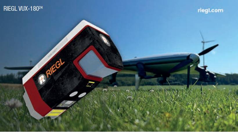
The new RIEGL VUX-180 24 offers a wide field of view of 75º and a high pulse repetition rate of up to 2.4MHz. These features in combination with a scan speed of up to 800 lines/s make it perfectly suited for high-speed surveying missions and applications where an optimal line and point distribution is required.
The RIEGL VUX-180 24 provides mechanical and electrical interfaces for IMU/GNSS integration and up to five external cameras, mirroring the form factor of the VUX-160 23. For data storage, an internal SSD memory with 2TB storage capacity and a removable CFast memory card are available.
This sensor further complements RIEGL’s already proven VUX-120 23, VUX-160 23 and VUX-240 24 series and is available as a stand-alone sensor or in various fully integrated laser scanning system configurations with IMU/GNSS system and optional cameras.
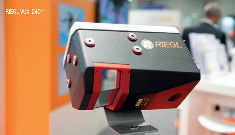
The RIEGL VUX-240 24 is the new enhanced version of the RIEGL VUX-240, now offering higher pulse repetition rates and faster scanning speed for further increased field performance and workflow efficiency.
A wide field of view of 75º and an extremely fast data acquisition rate of up to 2.4MHz, which results in a measurement rate of up to 2 million measurements per second, make the sensor suited for high point density applications like power line, rail track, and pipeline inspection. Its scan speed of up to 600 lines/s allows operations not only from fast flying UAVs, but also small helicopters, gyrocopters and other crewed aircraft at operating flight altitudes up to 4,700 feet.
There’s an optional integration of an IMU/GNSS system and up to four cameras. Data can be stored either on the internal 2TB SSD memory or with a removeable CFAST memory card providing quick data transfer to a PC.
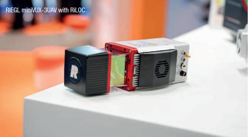
In addition to the stand-alone versions of the RIEGL miniVUX1 UAV and the miniVUX-3 UAV lidar sensor, RIEGL also offers system solutions with IMU/GNSS systems and cameras. Now RIEGL provides RiLOC, an integrated component to complement RIEGL’s kinematic lidar systems for localisation and orientation of lidar data in a reference coordinate system.
This fully integrated subsystem with a small and lightweight form factor is directly attached to the housing of the miniVUX-1 UAV or miniVUX-3 UAV with a total system weight of only 1.75kg. RiLOC itself consists of one or two GNSS receivers, an inertial measurement unit and a data acquisition controller with accompanying software.
It makes use of tight coupling in processing inertial, GNSS and lidar data providing a new entry-level option for RIEGL’s cost effective UAS lidar system solutions.