Tunnelling below, safety above
Megan Hansen, and Simon Hall, Leica Geosystems, with Craig-Lee Holt, Monitoring & Tunnelling Solutions Specialist, SCCS Survey
Monitoring one of the busiest UK highways during rail construction
AS critical transportation projects take place across the UK, monitoring existing nearby infrastructure for deformations is essential to ensure safety and continued operation. During the tunnelling of the HS2 high-speed railway under the M25 highway near London, SOCOTEC successfully monitored the difficult to access and busy motorway utilising automated laser scanning and a range of other monitoring techniques.
A high-speed train, a critical highway and a monitoring challenge
Britain’s first passenger railway opened in 1830, initiating a transit revolution. Nearly two centuries later, UK commuters still ride railways laid in the Victorian era while demand for more lines and faster cross-country connections has outpaced rail infrastructure development. The UK’s High Speed 2 (HS2), a dedicated high-speed railway currently under construction, will help alleviate these problems by linking major cities and airports to further connect Britain’s largest economic regions.
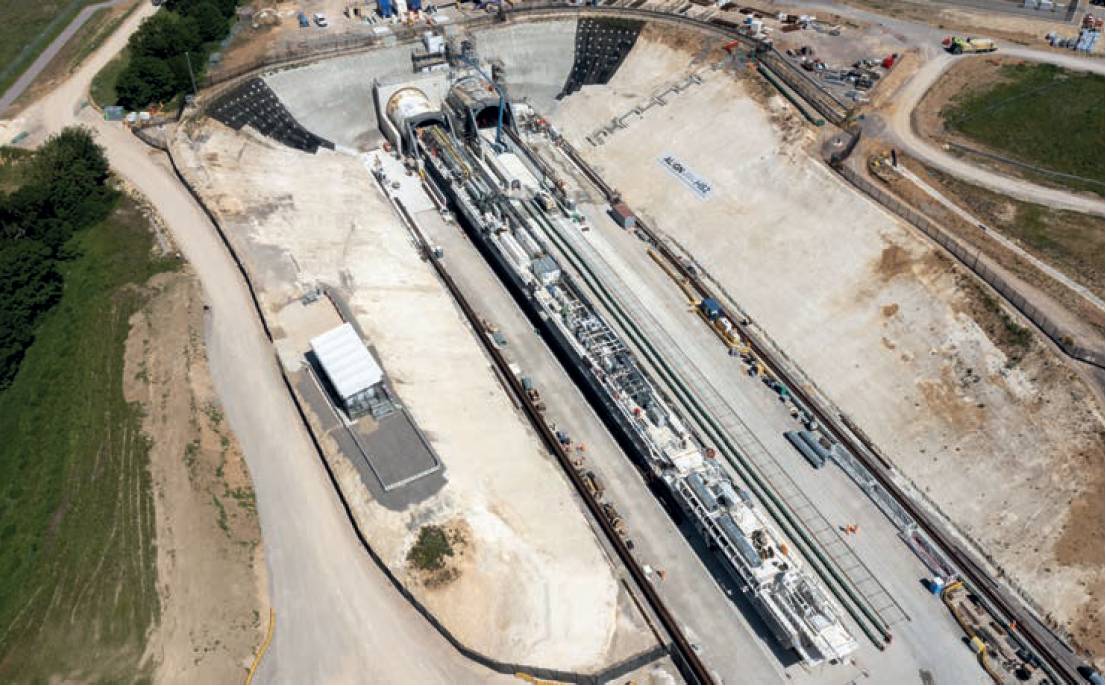
However, building this extensive railway between major cities, including London, Birmingham and Manchester, requires tunnel construction that potentially could disrupt existing transit and create structural deformations to the roadways above. This was the case for tunnelling under the M25, a critical national highway carrying over 250,000 vehicles each day along 117 miles of tarmac.
The construction of two separate tunnels underneath this asset led National Highways, a government-owned company in charge of maintaining the M25, to require a monitoring solution that would ensure the safety of travellers and evaluate the structural integrity of the roadway throughout the project’s progression.
Monitoring such a busy highway, however, posed problems: the roadway, with consistently high traffic volumes, had only limited access to monitoring areas and it was not feasible to close the highway for the initial or regular data collection during construction periods. At the same time, it was impractical to install prisms on the road surface where they would be destroyed by heavy vehicles or traffic would have to be redirected to avoid them.
Taking on the challenge
To meet this challenge, Align – the joint venture company completing 21.6km of the rail infrastructure, including the 16.04km twin-bored tunnels under the M25 – contracted SOCOTEC, a UK provider of testing, inspection and compliance services across industries.
Building HS2 between major cities, including London, Birmingham and Manchester, requires tunnel construction that potentially could disrupt existing transit and create structural deformations to the roadways above.SOCOTEC not only considered the practicality of the setup in terms of access and instrument installation, but it also wanted to minimise disruptions and, most importantly, secure the safety of M25 travellers and its own staff while working along the highway.
The project required minimal installation to the road surface, reduced installations to earthworks and the ability for the monitoring system to be fully remote and run autonomously 24/7 over several years.
This incorporated laser scanning and automation through the monitoring solution.
Patch scanning: Non-intrusive monitoring
The monitoring scheme was designed in consultation with SCCS Survey Equipment, and implemented a range of automated features, including patch scanning, imaging, instrument levelling and reporting.
The scheme comprised of:
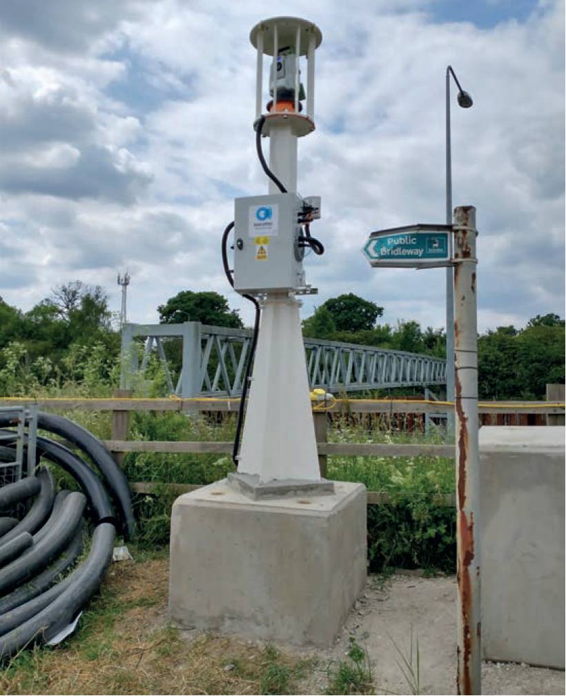
- GeoMoS monitor installed on a local site PC.
- Nova MS60 multistation. Nova TM50 monitoring total station.
- LOC8 theft deterrence and location solution.
- ComGate20 communication devices with enclosures.
- Instrument mounting monuments with security cages and AD12 self-levelling tribrach.
- GRP112 and GMP104 prisms.
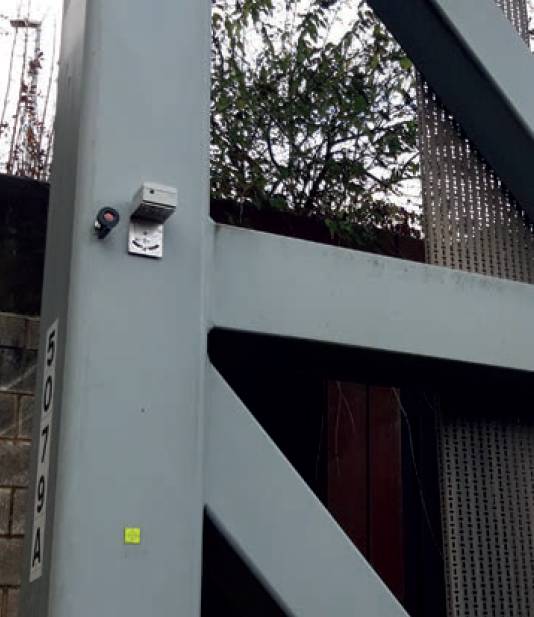
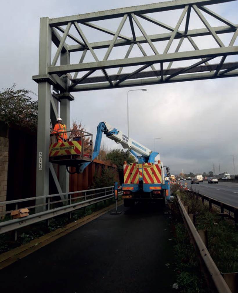
To solve the access and disruption issues, the client chose a nonintrusive monitoring solution called patch scanning that utilises laser scanning and automated monitoring software to generate data and analyses. The combination of the MS60’s laser scanner, with GeoMoS software minimised the need to install reflective targets or prisms and enabled monitoring to proceed in even the most restrictive areas. This decreased disruptions to live traffic during installation and operation, removed staff from potentially hazardous areas and ensured safety for road users.
The client captured reference measurement data for 12 months ahead of the excavations to determine the normal movements of the road surface.The client captured reference measurement data for 12 months ahead of the excavations to determine the normal movements of the road surface. During the monitoring period, the mulitstation, installed high up on adjacent plinths to optimise visibility, scanned small areas or ‘patches’ of surfaces at determined intervals with arrays of 20, 40 and 60 metres.
Other measurement arrays included prisms set up on the top of the embankments and multiple reflectorless points on structures. Additional prisms were installed as survey control in stable areas. Monitoring compared the measurements to baseline reference values, enabling deformation detection and notifications to key stakeholders if tolerance thresholds for movements were exceeded.
Additional automation for 24/7 monitoring
Further automation of the project using imagery to minimise visits to the site was also utilised. Remote access to live video and still images via integrated cameras in the multistation made it possible to resolve and verify data measurement questions.
The measurement sensors were centrally controlled through GeoMoS and used custom power sources with backups to ensure continuous monitoring.
Additionally, since the instruments were installed in remote locations where environmental factors could impact stability, the client needed a way to ensure the total stations remained level. It was possible to remotely and automatically activate the AD12 self-levelling tribrach for each TPS before each measurement cycle with remote and onsite training provided during the operation and delivery of the monitoring scheme.
Continuous monitoring benefits
Given the remote nature of the site, power outages and environmental factors weren’t the only issues the client had to consider when determining how to ensure 24/7 monitoring.
Given the remote nature of the site, power outages and environmental factors weren’t the only issues the client had to consider when determining how to ensure 24/7 monitoring.
To protect the equipment in the field, the instruments were mounted within secure cages and a theft deterrence and location system (Leica LOC8) installed to enable geofencing and alerts via messaging and instrument tracking and locking.
While useful for fleet management daily, this was crucial to the project when three instruments were stolen from the site.
It enabled the client to provide tracking information to local police, who recovered £120,000 worth of stolen equipment. which was then returned to the site so monitoring could resume as quickly as possible.
Results of the innovative monitoring system
Ultimately, the client’s use of the monitoring solution allowed the M25 to operate as usual during the tunnelling period, ensuring that one project to improve transportation didn’t interfere with critical existing transit.
Megan Hansen, and Simon Hall, Leica Geosystems part of Hexagon, with Craig-Lee Holt, Monitoring & Tunnelling Solutions Specialist, SCCS Survey