
A CLEARER LENS
Transport for Wales is currently in the middle of a once-in-a-generation project to modernise travel for people across south-east Wales. The South Wales Metro aims to transform travel across the region, with more frequent and faster journeys made on brand-new trains. The project, alongside multiple other projects to improve buses, walking and cycling, all aim to make Transport for Wales the favourite way for passengers to travel across Wales and its borders. Working on behalf of the Welsh government, over £1bn has been invested in updating the railway fleet, signalling systems, depots and control centres, along with new stations and infrastructure upgrades, to grow and integrate Wales’ transport capacity, allowing people to simply turn up and go.
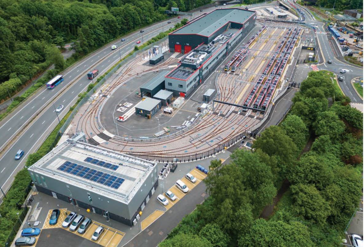
The £100m Taff’s Well depot, completed and opened in 2025, which will be home to TfW’s new fleet of tram-trains, introduced as part of the South Wales Metro project.
Across the South Wales Valleys, engineers are building a disconnected ‘smart’ electrified railway network for a new fleet of tri and bi-mode trains. These cutting-edge trains run on overhead electricity along electrified sections of the railway; automatically switching to battery power on non-electrified sections of the network. There are parts of the network where installing overhead wires would be prohibitively complex or costly, for example in tunnels, viaducts or under low bridges. When running along these sections, the train’s pantograph lowers and is powered using an on-board battery which is then re-charged when the train reaches an electrified section.
In addition, tram-trains will soon enter service, running along the Cardiff Bay line. The fully electric tram-trains can switch from running as a train on heavy rail tracks to running as a tram on street-level at the press of a button and are key for delivering future rail extensions like Cardiff Crossrail. These projects involve a lot of digging up and diverting buried services out of the way of new electricity pylons. Piling into the ground to create the foundations for each pylon requires knowledge of all buried utilities and cables which could be impacted by the work.
As railway transport is a historic industry, which celebrated its 200th birthday in 2025, it is not easy to obtain data about what lies underneath the ground ahead of excavation activities, increasing the risk of service strikes.
Transport for Wales began using the National Underground Asset Register (NUAR) as part of its safe digging process several years after the work to modernise and electrify the transport network across South Wales started. It was clear that NUAR would have been a great addition to the safe-digging process had it been available. Looking at future projects, NUAR will be playing a key role as Transport for Wales embeds its use across staff and supply chain contractors. NUAR is a government digital service that provides secure, instant access to a map of underground pipes and cables in England, Wales and Northern Ireland.
NUAR is a government digital service that provides secure, instant access to a map of underground pipes and cables in England, Wales and Northern Ireland.
Operated by Ordnance Survey on behalf of the government, it shares buried infrastructure data for telecoms, energy, gas, water, transport and local authorities. The map gives project managers better access to utility data and enables quicker planning for diverting or avoiding buried services. It gives excavators safer and more efficient on-site knowledge of services for installation, maintenance, operation and repairs of buried infrastructure.
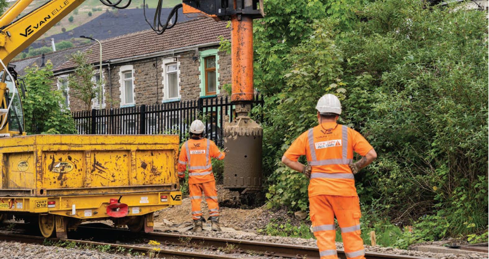
Piling and overhead line equipment installation on the railway line from Pontypridd to Treherbert, taken in 2023.
It increases industry co-ordination, because NUAR is a centralised and secure platform that shares a standardised view of underground asset data on the map. And it increases operational efficiency through instant access to data, reducing multiple requests for information that previously took on average six days to obtain.
In 2025, Transport for Wales began using it for constructing a new railway station at Butetown on the Cardiff Bay branch line. The project required excavation for a new lift shaft and entrances for easy access to the station. By using NUAR, it became immediately obvious how much simpler and quicker it is for assessing diversions and identifying utility owners. Instead of relying on a collection of individual documents to interpret, the key information was all in one place on a screen. As well as improving day-to-day safe digging processes, NUAR is also laying the groundwork for Transport for Wales to build an ‘informative twin’ of its utilities network.
An evolving digital twin enables engineers, designers and planners to understand site constraints earlier, model construction impacts more accurately and make better decisions long before work begins on site.
Because NUAR brings together multiple sources of underground asset data into one detailed map, it provides a digital replica of what lies beneath all its projects – be they bus, active travel or railway.
The incorporation of TfW’s ground penetrating radar and ‘as-built plans’ into an in-house version of the same model for underground data definition and integration (MUDDI) used by NUAR means that TfW is building on NUAR’s foundation and aiming to build its own digital twin of its utilities network. This evolving digital twin enables engineers, designers and planners to understand site constraints earlier, model construction impacts more accurately and make better decisions long before work begins on site.
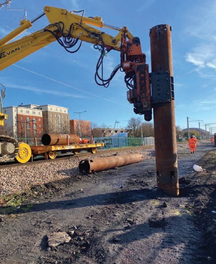
Piling works on the Cardiff Bay line to install overhead line equipment, used to power TfW’s fleet of electric trains.
If NUAR had been available two years earlier, it could have been used by project managers across South Wales to plan utility diversions to move pipes and cables out of the way to enable overhead line equipment to be installed safely. This would have been especially useful considering the amount of Victorian-era buried services found across the South Wales Valleys. It also would have helped improve planning for a myriad of supporting projects, such as the raising of bridge parapets to support overhead cables running underneath bridges. By identifying the owners of utilities that are contained within the highways, they could avoid significant costs should utilities need to be moved.
Testimonials from a number of Transport for Wales employees have sung NUAR’s praises, saying that it turns an hour or two of study into a couple of minutes work. Other benefits cited include allowing to capture the coordinates of sewer chambers so they can be checked against records, grouping the assets by their discipline and asset owner, which makes dealing with third parties much easier.
TfW asset engineers have been utilising NUAR to undertake searches for other utilities adjacent to an asset to better understand interfaces between these assets, prior to planning any site works. In addition, utilities coordinators have seen an increase in requests for NUAR access on non-rail projects – such as bus and active travel – and NUAR is helping project managers gain confidence working with buried utilities outside of the rail corridor, such as digging for new bicycle lanes, where many different utilities can be found.
There is also very strong potential for the data to be used for planning purposes. For example, if there were a plan to add a raised cycle network over a gas main, it would be very valuable to have this information so teams can do some smart designing that avoids these utilities. NUAR’s ease of use is of particiular benefit as it lowers the barrier to entry; any contractor can pick up their tablet and use it, and the platform is straightforward to demonstrate to project managers or people who have an interest in it.
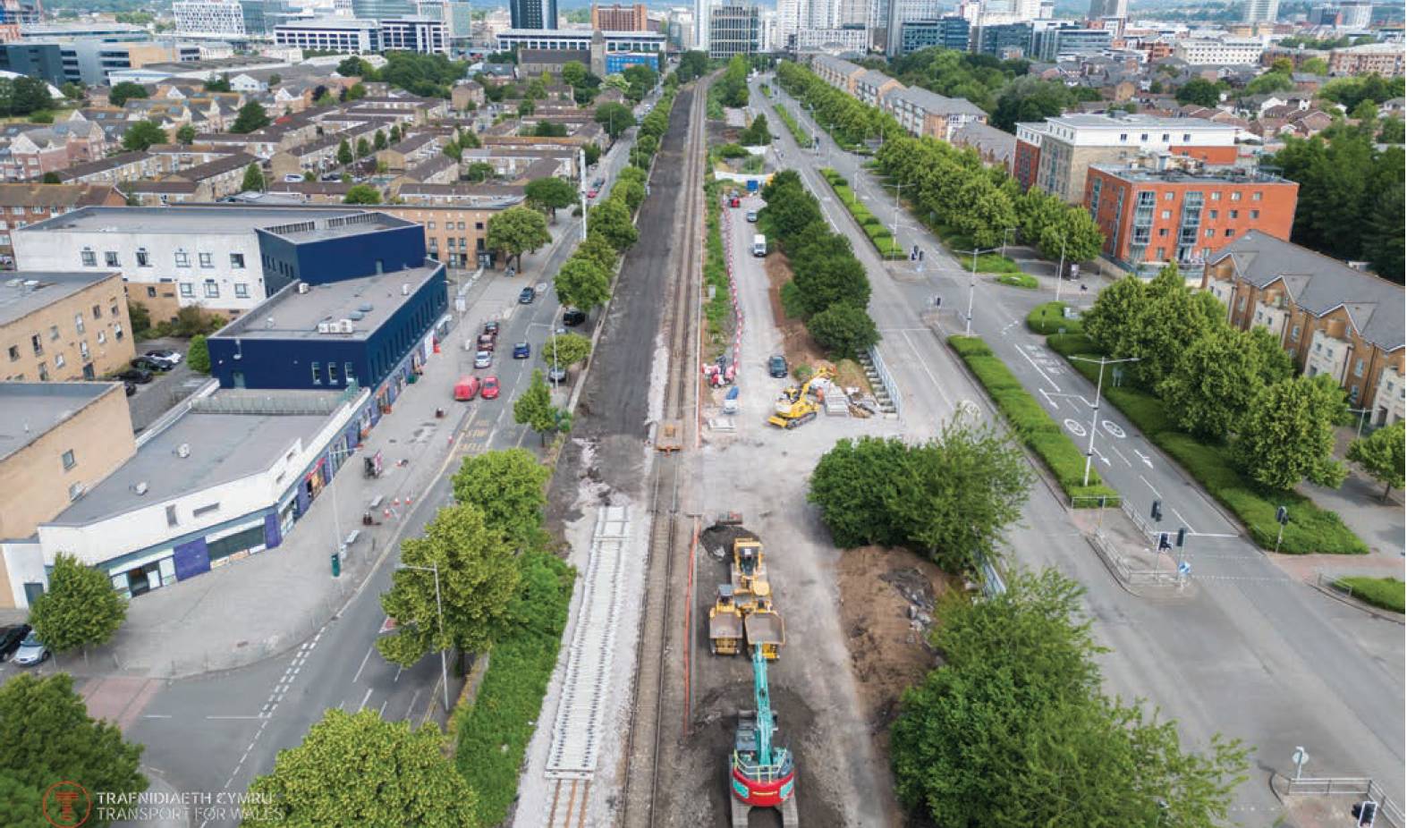
The line from Cardiff Queen Street to Cardi› Bay during transformation works. The railway line has been doubled along this stretch, OLE installed and a new station, known as Butetown, currently under construction.
Another benefit discovered though NUAR has been how it can help with scenarios around working safely above ground. Transport for Wales recently had an arborist contractor who had to cut down trees caught up in overhead fibre cabling, which wasn’t safe due to the fibre cable entwined in the trees. Using usual methods, it was incredibly difficult to determine whose overhead cables they were, but through NUAR the owner was discovered and their contact details passed on so the job could be completed.
Those with a GIS background have found NUAR intuitive and user-friendly, citing the ease at which it allows for the uploading of data. Accessibility is also an area that NUAR shines, with the Welsh language version being a real positive example for others in the utilities industry to follow, as well as safety, providing safe digging to people onsite that need to see what is underneath their feet.