The evolution of surveying through father and son
Lydia Gill, for Leica Geosystems, with Colin Murphy FCInstCES, Director, Murphy Geospatial
AS Leica Geosystems celebrates its 100th birthday, it has reflected on the people and companies integral to its journey over the decades. One part of this rich history is Murphy Geospatial, founded by the late Peter Murphy in 1983.
Creating a family business
At the start of his career, Peter Murphy joined BKS (since acquired by Fugro) in Northern Ireland, before moving into the mining industry as chief surveyor of Tara Mines. He became chief engineer for a Bauxite manufacturing project over a span of six years at what was one of the largest construction sites in Europe at the time.
After pursuing his career in surveying throughout the 1960s and 70s, he set up Peter Murphy and Associates in 1983, which has evolved into the Murphy Geospatial of today. Like many survey businesses, the company was founded on the reputation Peter Murphy had as an individual. He was a trailblazer and liked to be visionary in everything he did, challenging how he delivered surveying services. This enthusiasm put the company at the forefront of survey technology in Ireland.
Technology played a huge part in Peter Murphy’s life and career. In the words of his son, Colin Murphy, now director of Murphy Geospatial, even back in the 1980s, his father would have been seen as a ‘tech nerd’ — buying laptops when very few people had desktop computers, and staying on top of the latest software. He was a pioneer in survey technology and would manufacture bespoke cables to get computers and machines talking to each other, long before it was commonplace.
Like many surveyors, for Peter Murphy surveying wasn’t a Monday to Friday, nine-to-five job. It was a seven-day week and very much a part of him and his life. Colin Murphy recalls growing up seeing his father reading technical manuals on instrumentation and equipment, no matter the time of day. For him and his brothers, it could be frustrating during their childhood to have a father so embedded in his career, but now they can see why. Colin Murphy describes it as “more than just a job or career, it was his life.”
Peter Murphy died in 1995, and these values are instilled in his sons, with the four brothers at the helm today. The brothers vary in the skills, values and interests they bring to the business, but they all have that ingrained passion and determination.

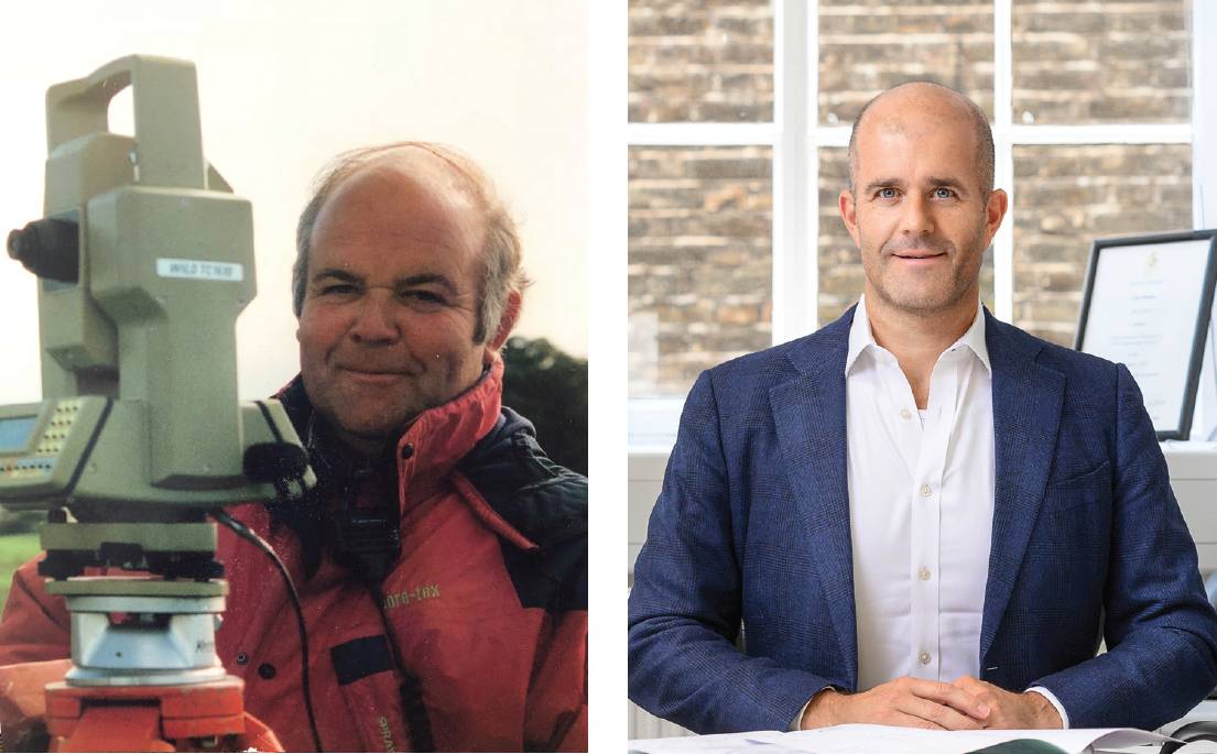
Father and son surveyors. Peter Murphy (l) and Colin Murphy (r).
Today’s business
Today Murphy Geospatial captures, collates, verifies and governs geospatial data through three key principles: People, process and technology.
Diverse skills are maintained through the now 300+ staff, with career paths and support for employees in place, including a CICES approved development scheme.
The business model and process that was developed and refined over almost 40 years has delivered over 25,000 projects for the company.
Partnering with leading industry technology providers continues. The relationship between Leica Geosystems and Murphy Geospatial started with Peter Murphy almost 40 years ago, when he worked with John Caffrey at Survey Instrument Services. It was very much a personal relationship that was built over the years – the relationship between industry manufacturers and users is highly important. Survey companies have hundreds of individuals out there using the kit and, with a fluid relationship, feedback helps manufacturers improve their products.
The evolution of surveying
Throughout the history of the survey industry, technology is one element that has improved significantly. This manifests itself in the speed at which data can be captured, how it can be captured and what can be done with it. However, the principles are very much the same. Quality is still at the forefront of the industry – the challenge is to stay on that course as technology advances.
Even back in the 1980s, his father would have been seen as a ‘tech nerd’ — buying laptops when very few people had desktop computers, and staying on top of the latest software.There are some practices engaging in rapid capture of data and not applying the fundamentals of surveying. That presents a challenge for survey purists, as the accuracy needs to be maintained. The principles of surveying need to be adhered to and engaged with modern forms of data capture, whilst aligning with delivering outputs in an accessible way. There’s an ethical accuracy in collecting good clear verified data.
The future
The future of surveying will be a combination of big data and how surveyors engage with that. The capture of data will be simplified to a certain extent, but with that vital focus on efficiency and accuracy. Surveyors are ultimately the data custodians for each project.
Murphy Geospatial will be building on that data management basis with client-side engagement. To really deliver geospatial certainty for clients on major projects and strategic partnerships, surveyors need to be seen as and felt as an extension of their own resource.
As in many sectors, resources are the number one threat. Murphy Geospatial works closely with universities, such as TU Dublin and Newcastle University, to build interest for the next generations.
Surveying is not the mucky boots in fields that it is often thought to be. Surveyors need to educate the next generation on the data, technology and analytics which form the survey industry today.
Lydia Gill, for Leica Geosystems, with Colin Murphy FCInstCES, Director, Murphy Geospatial
https:// murphygs.com @m_geospatial https:// leica-geosystems.com @LeicaGeosystems