Hydrography and coastal resilience
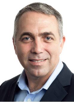
Paul Seaton, Hydrography and Coastal Resilience Director, Fugro, talks to Danielle Kenneally

RISING sea levels are resulting in more coastal erosion, overtopping of defences and salinification of land but there are people and technologies that are aiming to prepare and devise strategies to reduce the environmental impact using the knowledge gained through data sharing, collaborative partnerships and technology innovations that are ever-evolving. Fugro director of hydrography and coastal resilience, Paul Seaton, talks to the Civil Engineering Surveyor’s Danielle Kenneally about the increasing interest on blue economy, demand for hydrographic survey services and marine site characterisation, as well as some of the most recent developments in hydrographic survey technology. He also details the need to address climate change by lowering our impact on the environment and why investment support in geo-data is critical for coastal communities for sustainable infrastructure.
Tell us about your role
As director of hydrography and coastal resilience I lead a skilled team that acquires and analyses seabed data, from shallow coastal zones, right out to full ocean depths. We also provide expert advice to Fugro’s range of clients that includes government bodies and private sector organisations. Utilising different platforms, methods and equipment, including conventional and autonomous vessels, airborne lidar bathymetry and satellite imagery, we produce high-resolution data on the sea floor and provide observations on features or hazards.
Traditionally, the data we collect are used for the production of nautical charts, marine habitat mapping and telecommunications cable route surveys. But now, more than ever, they are also essential for coastal resilience planning and environmental management as well as for the development of sustainable infrastructure.
Does your role change as technology evolves?
I work closely with clients to understand their needs and guide the strategy for measuring, analysing and communicating the information they want. The often-complex nature of clients’ projects and the need to manage the challenges of climate change, together with the accelerated transition to renewable energy, underpins my focus on innovative technology.
Fugro’s reputation for innovation goes back over sixty years. Our newest technologies and developments include autonomous vessels, modern systems and equipment, remote command and control operations, rapid data delivery, machine learning, artificial intelligence and scalable solutions. These elements improve efficiency, minimise human exposure to risk and lower our impact on the environment, and as we integrate them into our projects, our roles adapt and continue to evolve alongside them.
How does what you do continue to be important to those in the industry?
With more stakeholders becoming interested in the blue economy, demand for hydrographic survey services and marine site characterisation continues to rise. Key drivers include the accelerated transition to offshore wind energy, the economic need for more subsea telecommunication cables and the ongoing requirement for safe and efficient navigation for trade, transport, tourism, fishing and other maritime industries. Additionally, the rapid growth in world population is increasing the demand for geo-data across the land-sea interface, where coastal communities need investment support for sustainable infrastructure.
Traditionally, the data we collect are used for the production of nautical charts, marine habitat mapping and telecommunications cable route surveys. But now, more than ever, they are also essential for coastal resilience planning and environmental management as well as for the development of sustainable infrastructurCommunities that are exposed to events related to climate change, such as sea level rise and increased frequency of storms, are at risk of severe shortages of food and fresh water as well as the loss of infrastructure and economic activities, including fishing, tourism and trade.
Hydrographic data acquisition and analysis can measure physical coastal risks and monitor the impact of changes over time. Expert advice can then support vulnerable communities in infrastructure planning and risk mitigation. While on a global scale, Fugro also has a significant role in two important ocean-focused initiatives:
- The Nippon Foundation-GEBCO Seabed 2030 Project – A collaborative project aiming to bring together all available bathymetric data to produce a definitive map of the world’s ocean floor by 2030, making it available to all. By December 2021 Fugro had delivered to the project over two million km2 of high-resolution, in-transit bathymetry collected by our vessels.
- United Nations Decade of Ocean Science (2021-2030 ) – Envisages a revolution in ocean science that will trigger a step change in humanity’s relationship with the ocean, bringing together stakeholders to generate scientific knowledge and develop a well-functioning, productive, resilient and sustainable ocean. Fugro is assisting the private sector in support of the Ocean Decade through data sharing, collaborative partnerships and technology innovations in pursuance of the vision, ‘the science we need for the ocean we want.’
What new hydrographic developments are there in the surveying industry?
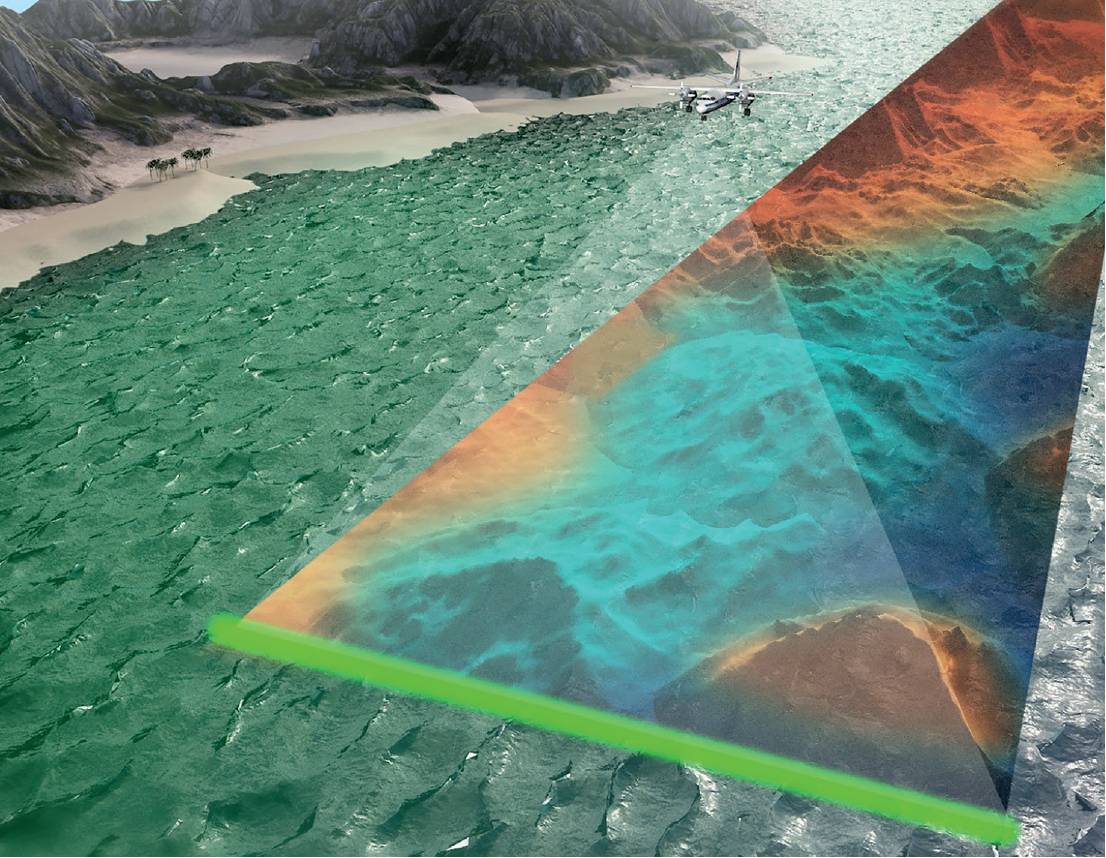
Fugro has been involved in developments in hydrographic survey for decades, particularly in the way in the field of remote operations from 2013 and growing the scope and scale of remote services since. As well as remote operations centres (ROCs), which enable faster and safer acquisition and delivery of data, and with a significantly reduced carbon footprint, advances in remote technology have also contributed to innovations in autonomous and uncrewed platforms. Different aspects of marine survey, mapping and underwater inspection are today supported by uncrewed surface vessels (USVs), autonomous underwater vehicles (AUVs) and uncrewed aerial vehicles (UAVs). Other remote sensors, such as airborne lidar bathymetry (ALB) and rapid airborne multibeam mapping systems (RAMMS), provide efficient, fast and accurate marine data acquisition.
With more stakeholders becoming interested in the blue economy, demand for hydrographic survey services and marine site characterisation continues to rise.Utilising secure satellite or point-to-point communications, machine learning applications, cloud processing and artificial intelligence, we are acquiring data on, under and above the sea and enabling access in near-real time by shore-based clients, processors, analysts and consultants. Perhaps one of the most significant developments in the survey industry recently is the human element. At Fugro we have invested in a dynamic people plan to match the speed of technological evolution. It means cognitive skills, combined with mental resilience and an openness to new ways of working are blended with traditional competences.
What are you most excited about and why?
The emerging use of visualisation tools is one of the most exciting new developments. Fugro has developed a cloud-hosted, web-based geo-data engagement platform that enables visualisation and sharing of up-to-date documentation and data in near-real time. My team is using this platform to share insights into the specialised hydrographic data and information on changes or risks, as they are detected. With no need for specialised software or GIS experience, all internal and external stakeholders have access to a ‘digital twin’ model as well as a wealth of other geo-data. Instant, round-the-clock access to this single source of truth is enhancing decisionmaking and advancing the way we work collaboratively, encouraging complete utilisation of valuable datasets.
What is currently the most used solution for those in the industry and is it used because it is all that is needed or is it something that needs improvement to develop it into something better?

Rapid airborne multibeam mapping systems.
Most hydrographic surveys remain focused on the use of vessel-mounted multibeam sonar equipment and other well established remote sensing technologies for the collection of hydrospatial data. Until recently methods have remained broadly similar, with traditional solutions generally delivering sufficiently high-quality data for processing and analysis. But there is always potential for improvement and as we observe growing demand for accurate hydrospatial data we are driving improvements in efficiency and business continuity, whilst also minimising human exposure to risk. Perhaps more urgent, however, is the need to address climate change by lowering our impact on the environment.
By replacing conventional survey vessels with autonomous vessels and utilising other technological advances like airborne lidar bathymetry, we are already making significant improvements. For example, Fugro’s uncrewed surface vessels reduce fuel consumption by as much as 95% compared to conventional vessels.
What’s more, for our clients the carbon footprint is influencing their choices on how we execute their projects. This will undoubtedly have a major impact on our industry, as well as wider operations, and is a trend we expect to continue.
Are there more developments you wish to see and what does the future hold?
Perhaps one of the most significant developments in the survey industry recently is the human element
We need to be open to the broader use of hydrospatial data, with a greater focus on information that will support the management of marine and coastal environments. And with the resulting exponential increase in volumes of data, it is essential that the application of cloud-based machine learning and artificial intelligence stay ahead of this growth.
Another significant development concerns collaboration with stakeholders and the benefits of working together to integrate social, economic and environmental considerations into decision-making. We are increasingly engaging with communities and believe that public-private partnerships will deliver significant benefits to all stakeholders.
Finally, helping to contribute to a safe and liveable world means replacing conventional methods of data collection with more low carbon emission solutions. At Fugro we are investing in new technologies such as autonomous vessels and remote sensors. While minimising the exposure of our people to risk, we are also reducing our environmental impact, and with these initiatives we are confident of achieving our target of net zero operations by 2035.
Paul Seaton, Hydrography and Coastal Resilience Director, Fugro, talks to Danielle Kenneally
p.seaton@fugro.com www.fugro.com