Protecting blue carbon ecosystems
Andy Waddington MCInstCES, VP Bathymetric Services, and Erik Josefsson, CEO R-evolution, Hexagon AB
IN December 2021, Hexagon AB announced that its sustainability business R-evolution was to map the threatened seagrass meadows of the Caribbean islands, beginning with the coastal waters of the Bahamas. In collaboration with Beneath The Waves – a global, non-profit organisation dedicated to protecting marine environments – airborne bathymetric LiDAR is being used to detect, map and capture critical details about this vital habitat, including its extent and composition.
Blue carbon ecosystems
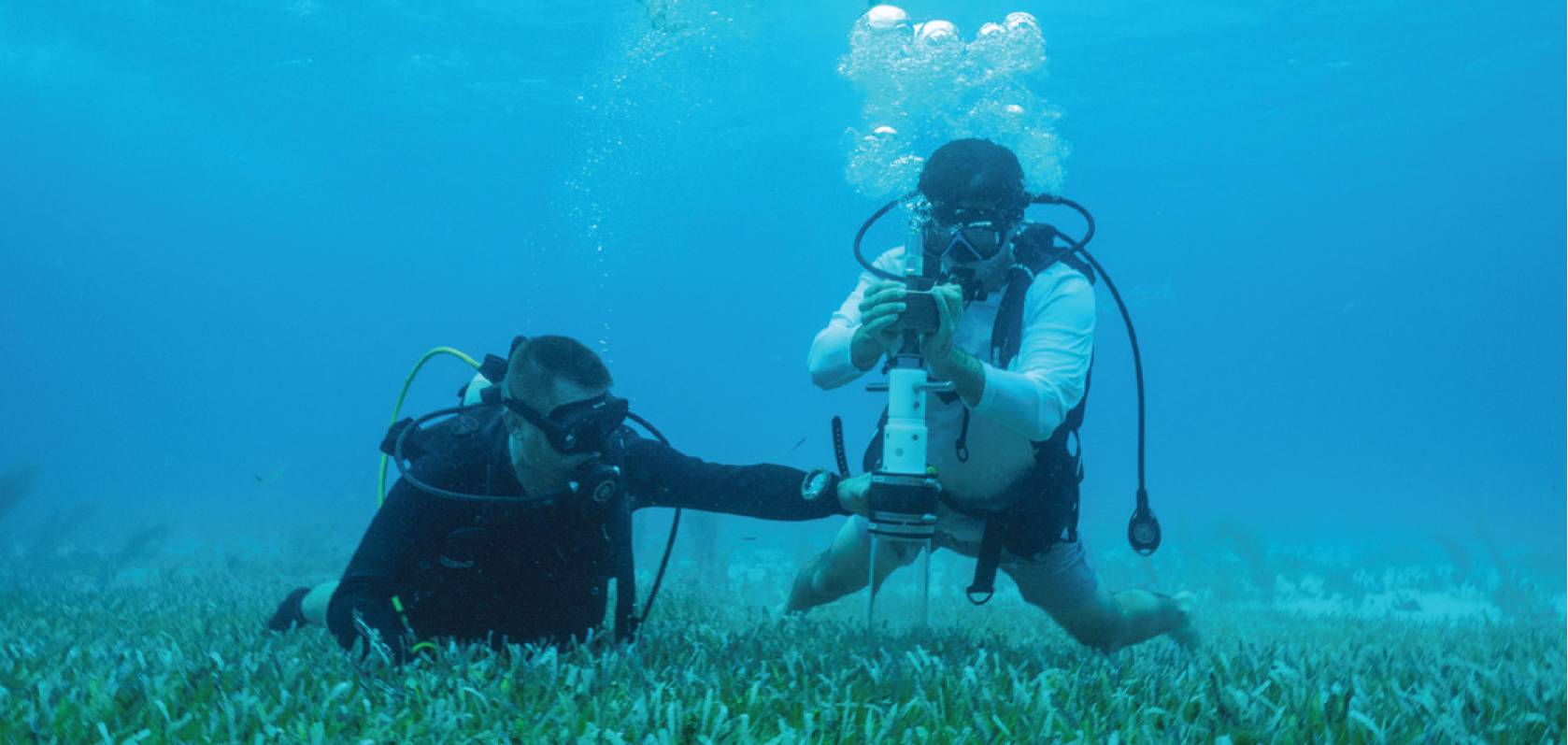
Taking samples to calculate the amount of stored carbon.
Blue carbon ecosystems refer to coastal and marine vegetated habitats, such as seagrass meadows, salt marshes, and mangrove forests, that sequester and store carbon from the atmosphere and ocean. These powerful carbon sinks are rapidly disappearing in many parts of the world. Seagrass meadows, the most common among them, are crucial to solving environmental challenges yet remain among the least recognised and least protected ecological habitats.
Seagrass is an important part of the coastal biodiversity-ecosystem, providing a habitat for small fish and a food source, as well as protection, for migratory birds. Due to their capacity to store organic carbons in sediments, seagrass meadows are five-to-eight times more efficient in carbon capture than forests. And, since most carbon is stored in soil and sediments, it can remain there for millennia if left undisturbed.
Current measurement techniques by satellite are not accurate enough to baseline wide areas of seagrass. Utilising Beneath The Waves’ science and aqua experience and bathymetric LiDAR, we can play an essential role in supporting, preserving and unlocking the power of nature to build climate resilience.
Mapping seagrass
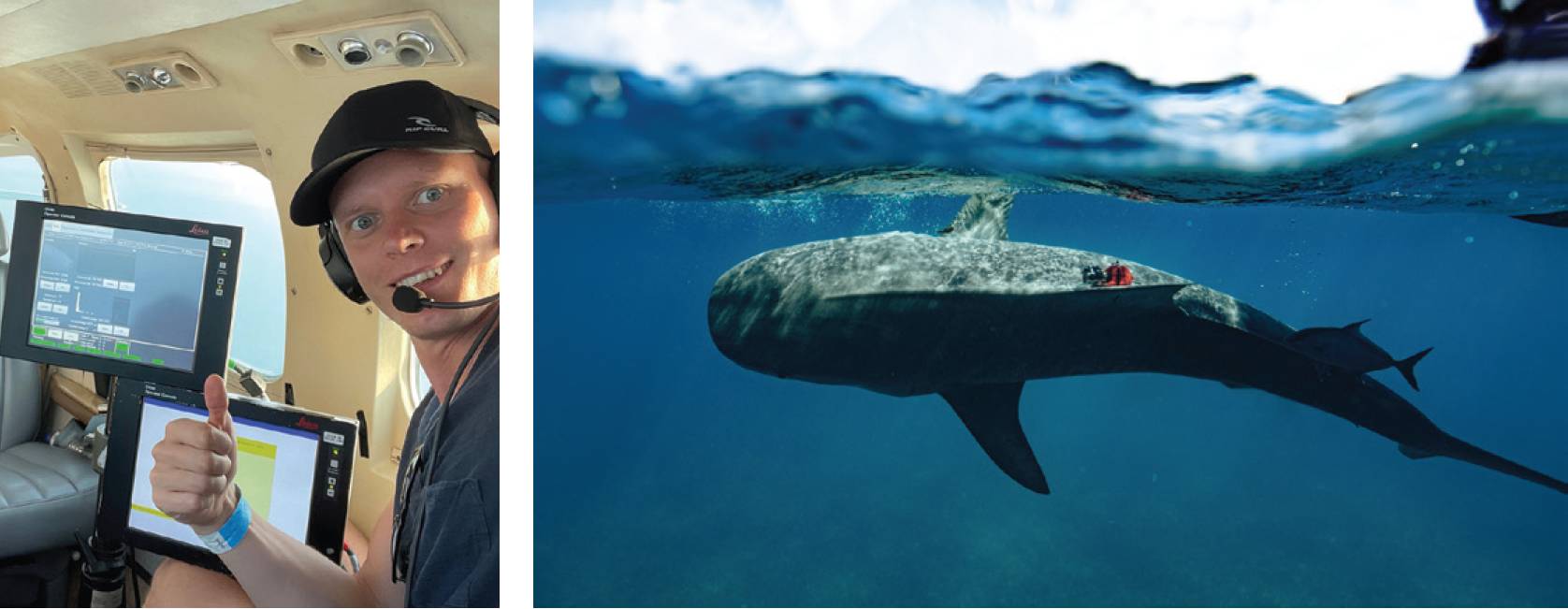
Left: The survey aircraft geared with the airborne bathymetric LiDAR. Right: A combination of sensor tagged sharks, satellite data, marine vessel surveys and scuba divers mapped the seagrass meadows.
As part of a long-term shark monitoring project to study and protect the oceans, Beneath The Waves discovered that tiger sharks spend a large portion of their life patrolling and foraging dense seagrass meadows. A combination of sensor-tagged sharks, satellite data, marine vessel surveys and scuba divers drove the ongoing discovery and mapping of the extensive seagrass meadows of the Caribbean. But to protect and restore these blue carbon sinks, the findings must be validated with high positional accuracy and datasets that can provide efficient, year-on-year change detection and monitoring.
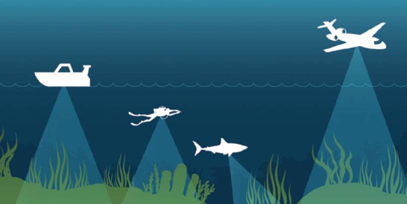
Combined data collection methods used on the Blue Carbon Project.
R-evolution is helping Beneath The Waves validate their findings by deploying survey aircraft geared with one of Hexagon’s airborne bathymetric LiDAR solutions, the Leica Chiroptera 4X.
The airborne bathymetry solution enables the cost-effective, rapid survey of large areas – accurately mapping thousands of square kilometres of seabed habitats at up to 30m water depth in just a few days.
The high-resolution point clouds and aerial imagery will allow Beneath The Waves to scale up its marine research.
Bathymetric surveying supports environmental monitoring by mapping and classifying submerged vegetation and habitat to assess aquacultures, study marine ecology and hydrodynamics.
Mapping large areas with vessels, divers and sharks is a long and resource-heavy process. The benefits of airborne bathymetric LiDAR are that:
- Seagrass for carbon sequestration is hampered by a lack of accurate measurement.
- Airborne survey can improve the efficiency, resolutions and accuracy of the survey while covering the same area in just a few days, offering a more time and cost-effective solution.
- Bathymetric LiDAR mapping is easily repeatable, offering an excellent basis for year-on-year change detection and monitoring.
- LiDAR point clouds provide 3D elevation and land classification information with higher positional accuracy and spatial resolutions compared to the 2D coverage of satellite imagery data.
- Airborne bathymetry systems are optimised for shallow water data collection, which makes them ideal for mapping seagrass which grows primarily in water depths of 30m and less.
The Blue Carbon Project project has the potential to launch one of the world’s most impactful nature-based mitigation efforts while protecting biodiversity in the Caribbean Islands and beyond at the same time.
Andy Waddington MCInstCES, VP Bathymetric Services, and Erik Josefsson, CEO R-evolution, Hexagon AB
https://r-evolution.com/r-projects