The impact of automation on the geospatial professions
Khalid Sheikh Fakhar, Chief Scientist, Sensat, Olivia Powell, International Lead, Geospatial Commission, Simon Navin MRICS MCInstCES, Geospatial Service Lead, Jacobs and Yung Loo, Senior Engineer, Arup
NOVEMBER 2021 saw the welcome return of the GEO Business show after an enforced hiatus due to the pandemic. While some aspects of life have felt on hold for almost two years, technology growth – and in particular geospatial technology – has continued apace.
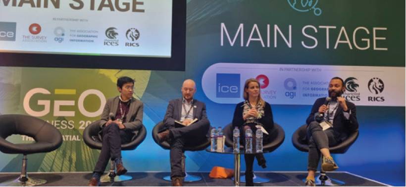
The drive for automation in the geospatial profession was one of the topics tackled by the show, and a panel representing the views of science, civil engineering, surveying and government was charged with exploring the topic, chaired by CICES fellow Vanessa Lawrence CB.
Khalid Sheikh Fakhar, chief scientist at Sensat; Olivia Powell, international lead at the Geospatial Commission; Simon Navin, geospatial service lead at Jacobs; and Yung Loo, senior engineer at Arup, looked at artifical intelligence (AI), mass data collection and machine learning and how they stand to impact the way the geospatial professions work. Following the panel’s appearance at GEO Business, they shared their thoughts with Civil Engineering Surveyor.
What do we mean by automation?
Khalid Sheikh Fakhar: Automation is an application of technology which aims to replace manual workflows with machines and algorithms, minimising human input in the process. Yung Loo: At a basic level, it enables us to spend less time doing repetitive tasks – it is about doing what we already do faster. However, automation goes far beyond this and provides opportunities for us to use that time to explore solutions in more detail and more thoroughly than would otherwise have been possible.
Khalid Sheikh Fakhar: It is more than greater insights and better outcomes. Automation is a seamless process of knowledge transfer between a slow and restrictive physical world to a fast and superhuman digital world.
What does automation mean for geospatial?
Olivia Powell: For me, geospatial automation relates to two main processes; upstream (source) and downstream (processing and output). Upstream, for example, we have the automation of data capture using machine learning or AI on earth observations to extract spatial features at scale in real time, from swimming pools in cities to un-recorded settlements in developing countries and deforestation in Amazonia. Downstream, for example, we have automation combining and analysing multiple and large datasets to create new insights. Gone are the days when people were interested in ‘static’ maps, data is now big and changeable and automation can help keeping data live.
Simon Navin: For the built and natural environment professions it is transformational. As data volume and complexity increases, it becomes ever more difficult for humans alone to manipulate information to gather insight or create the outputs that will add value and create efficiency. Automation is essential.
Khalid Sheikh Fakhar: The focus is shifting from data capture, cleansing and processing to solving complex global problems, making geospatial the most impactful industry in the coming decades.
Should we be worried?
Khalid Sheikh Fakhar: Absolutely not. The geospatial professions have probably seen the fastest evolution of any in the past couple of decades. In parallel to the obvious threat to manual labour, there will be a high demand for solution development. Automation will be key to extracting valuable insights and knowledge from naturally large datasets, faster than ever before.
Simon Navin: We should be mindful rather than worried. The benefits are obvious of course. We should always recognise that there is an inherent human cost with any technological development, however. We need to ensure that the profession is moving at a rate of change that supports those who will be most impacted and who may be anxious about the challenges that automation may bring.
Yung Loo: The opportunities should be embraced across the whole workflow of an engineering project – from layout optimisation, to spec checking, to improved payments processing. Parametric through to generative designs are supported by rich geospatial data and having that data in real time with the freedom to iterate provides more of an informed balance against traditional engineering judgment and rules of thumb.
Olivia Powell: Automation can actually help ‘sell’ the benefits and unlock the value of geospatial data. With more datasets available in a timely fashion, it provides a fuller and more attractive picture for decision makers. We still need humans to calibrate the algorithms and workflows; to assess problems to solve; and to have the creativity to identify new data streams and sources.
The term ‘augmented intelligence’ is more appropriate where automation helps us, geospatial data specialists, be better at what we do. I’ve witnessed a real lack of investment in geospatial capability in the police sector, for example, and in situations like this, automation is the light at the end of the tunnel to help individual GIS teams keep abreast of the workload.
Geospatial data specialists are like unicorns! We have a geospatial capability gap in the UK and that’s true globally.
What are the biggest automation opportunities for geospatial?
Simon Navin: It’s easy to focus on technology as the outcome for some of the big opportunities such as climate response mitigation or improved mobility. But technology – and automation – will always only be an enabler of the outcome. It should be virtually invisible to the end beneficiary in most cases, like improved early warning systems for weather events or automated traffic management to tackle air pollution. These will create massive benefits to humans who in most cases will have little or no awareness of the complex processing happening in the background. Automation will be the silent cure for many of the planet’s ills.
Olivia Powell: I could not say it better! In the wake of COP26, we cannot lose track that geospatial automation will play an invaluable role in monitoring, predicting and hopefully mitigating climate change impacts as well as contributing to reaching net zero targets.
Khalid Sheikh Fakhar: A fully automated construction site where minimal or no human input is required will not only bring the construction industry into the digitised realm it will become the poster industry for the use of geospatial and AI in saving the planet. We’re already seeing benefits of geospatial automation in agriculture, with drones, fully autonomous vehicles and biotechnology both increasing yields and leading to less use of pesticides.
Yung Loo: In construction, the biggest opportunities are where we will make vast step forwards in efficiencies – making better informed decisions, benchmarking designs and getting surety on cost. There are countless examples from small-scale projects to major capital projects. Things like automated tunnel alignment route finding, where we get to fully consider engineering, environmental and planning constraints quickly. We have data rich visualisation of real-time results in clear dashboards. We can benchmark construction costs, including whole life carbon costing. Satellite remote sensing and automation of data capture and processing for land classification are more real-world examples we’re providing to clients now. And automation of asset inspection surveys is a big area where there are health and safety benefits from removing personnel from confined spaces and hazardous areas. Automated data collection using photogrammetry and LiDAR is giving us significant cost savings in man-hours and improved quality, objectivity and repeatability of the data collected.
Olivia Powell: One other opportunity is that data skills are in increasingly high demand across all sectors. Geospatial data scientists and specialists are like unicorns! We have a geospatial capability gap in the UK and that’s true globally. Whilst skills programmes are aiming to develop more people with the right skills and tools to work with location data, what we need to do now is to grasp the opportunity to pull resources and collaborate better with colleagues across sectors and across professions.
Khalid Sheikh Fakhar: Coming from a computer science and GIS background, I have witnessed disparity in the evolution of the two subject areas. GIS relied on computing to provide algorithmic solutions, and software never utilised geospatial data appropriately. However, I am excited the time has come when the two cannot stay separated. I strongly believe the biggest opportunities in the automation field will arise from the amalgamation of geospatial and AI skill-sets.
Yung Loo: The shape of delivery teams is changing, alongside engineers, technicians and surveyors, now we require digital engineers, coders, data scientists and software developers.
Embracing digital and geospatially enabled engineers is crucial in ensuring inclusivity of growing skills outside of previously more rigid criteria. Digital apprenticeships are becoming more important, ensuring that digital natives can grow their capabilities and apply them to real industry problems.
How should SMEs be engaging with automation and what will be expected of them?
There are already concerns that the areas of expertise they are delivering are becoming increasingly commoditised and just saying that a workforce can re-skill or be released for higher value tasks isn’t always grounded in reality.
Khalid Sheikh Fakhar: Construction requires a shake-up (aka disruption – even though I don’t like the term!). SMEs are perfectly placed to embrace the automated future and innovate rapidly. As analogised many times, large organisations are like huge ships in the sea; they take time to turn. While smaller innovative and super-ambitious SMEs have the ability to bring solutions to the market rapidly. They may lack real-world use cases and client experience but they have that ability to pivot rapidly and learn from their failures fast. Think big (be ambitious). Act small (in quick iterations). Fail fast (learn from mistakes and build again).
Simon Navin: Some SMEs will be very well positioned to adapt and will have ‘grown up’ in the automation revolution era. A lot of SMEs and geospatial practitioners will see this as a significant challenge too. There are already concerns that the areas of expertise they are delivering are becoming increasingly commoditised and just saying that a workforce can re-skill or be released for higher-value tasks isn’t always grounded in reality. Industry and government will need to carefully support the transition that a lot of organisations and individuals will be faced with, ensuring that legacy skills are utilised and that members of the workforce aren’t pushed out of their industry sphere. Ways to engage and change the way work is delivered while protecting the workforce will be crucial.
Yung Loo: We’ve certainly seen a shift with survey companies diversifying towards analytics and insights. Just looking at the number of start-ups and SMEs growing in this space, and the number of requests for partnering we have at Arup, shows that automation is an opportunity if embraced in the right way. Automation can level the playing field for SMEs who might have previously not been competitive against big firms. Larger firms will be looking to SMEs to bring on board capabilities and technologies that can feed into both their existing processes and higher quality, end-client deliverables.
Olivia Powell: The need for geospatial data is only going to grow. We’ve seen the propagation of start-up programmes like Geovation and Satellite Catapult in the UK, GeoWorks in Singapore, St Louis Geospatial Hub in the US. There is more to come, and there will be opportunities for engagement.
What role do the geospatial professions have to play as automation is adopted more widely?
This is a fantastic evolution, although aspects of the geospatial professions are still at significantly different levels of maturity.Simon Navin: GEO Business (and its previous incarnations) was an event kicked off by the land survey profession. It quickly brought in engineering survey and latterly GIS and geospatial, and now data and data science. This is a fantastic evolution, although aspects of the geospatial professions are still at significantly different levels of maturity.
The professions are moving at different paces and it’s more important than ever that we see the likes of CICES, RICS [Royal Institution of Chartered Surveyors], TSA [the Survey Association], AGI [Association for Geographical Information] and the Geospatial Commission aligning. We need to see complementary roadmaps that show that no one will be left behind and that the benefits of automation, and the incredible outcomes and value that can be created through its utilisation, will apply to all.
Yung Loo: My particular professional body, the ICE [Institution of Civil Engineers], is taking steps towards expanding its criteria and appreciating a growing base of members and capabilities. There is more and more overlap between the professional bodies and collaboration and consistency across the board will become more important. On the flip side,
we must also ensure that the integrity of the core professional domain – traditional engineering judgment and capability – does not get eroded away by unchecked, invalid or poorly applied automated insights. At the sharp end of engineering, mistakes can lead to structural failures and loss of life.
Olivia Powell: Geospatial professions have a role to play in ensuring two principles. Firstly, automation cannot provide reliable outcomes if data is not of good quality, findable, accessible, interoperable and reusable – QFAIR. There is a question around standards to ensure the output from automation is the most reliable it can be to support decision making. Secondly, and partly consequently, as professionals we need to ensure we consider ethics and privacy issues when using geospatial and AI. I often quote Robert Cardillo, former director of the USA’s National Geospatial Intelligence Agency, who said “machine learning and AI have the power to propel us to radical and beneficial transparency – no going back.”
Khalid Sheikh Fakhar, Chief Scientist, Sensat, Olivia Powell, International Lead, Geospatial Commission, Simon Navin MRICS MCInstCES, Geospatial Service Lead, Jacobs and Yung Loo, Senior Engineer, Arup
This article is adapted from the panel session, The Drive for Automation in the Geospatial Profession, at GEO Business 2021.