Topographical surveys for asset management
Lucy Hamilton, KOREC
THE rise in demand for domestic holidays has presented Three Sixty Group with some interesting measurement challenges following a contract to carry out a topographical survey of five residential holiday parks in Cornwall and Devon.
Tight travel restrictions have created the highest level of interest in UK domestic holidays for decades with VisitBritain predicting that home tourism spending will reach £51.4bn this year, up 51% on 2020 (although this is down on 2019 levels due to the lockdown). Consequently, investor interest in areas such as holiday parks is high with owners and developers alike wanting to know exactly where their assets are located and what they entail.
In particular, following the purchase of a number of holiday parks in the Cornwall and Devon area, Enzygo and Park Holidays wished to establish exactly what its investment covered to better understand each and every asset for valuation, development and maintenance purposes. With site survey information for these recently acquired parks either non-existent, incomplete or out-of-date the company contacted Three Sixty Group to undertake a full topographical survey of the locations in question.
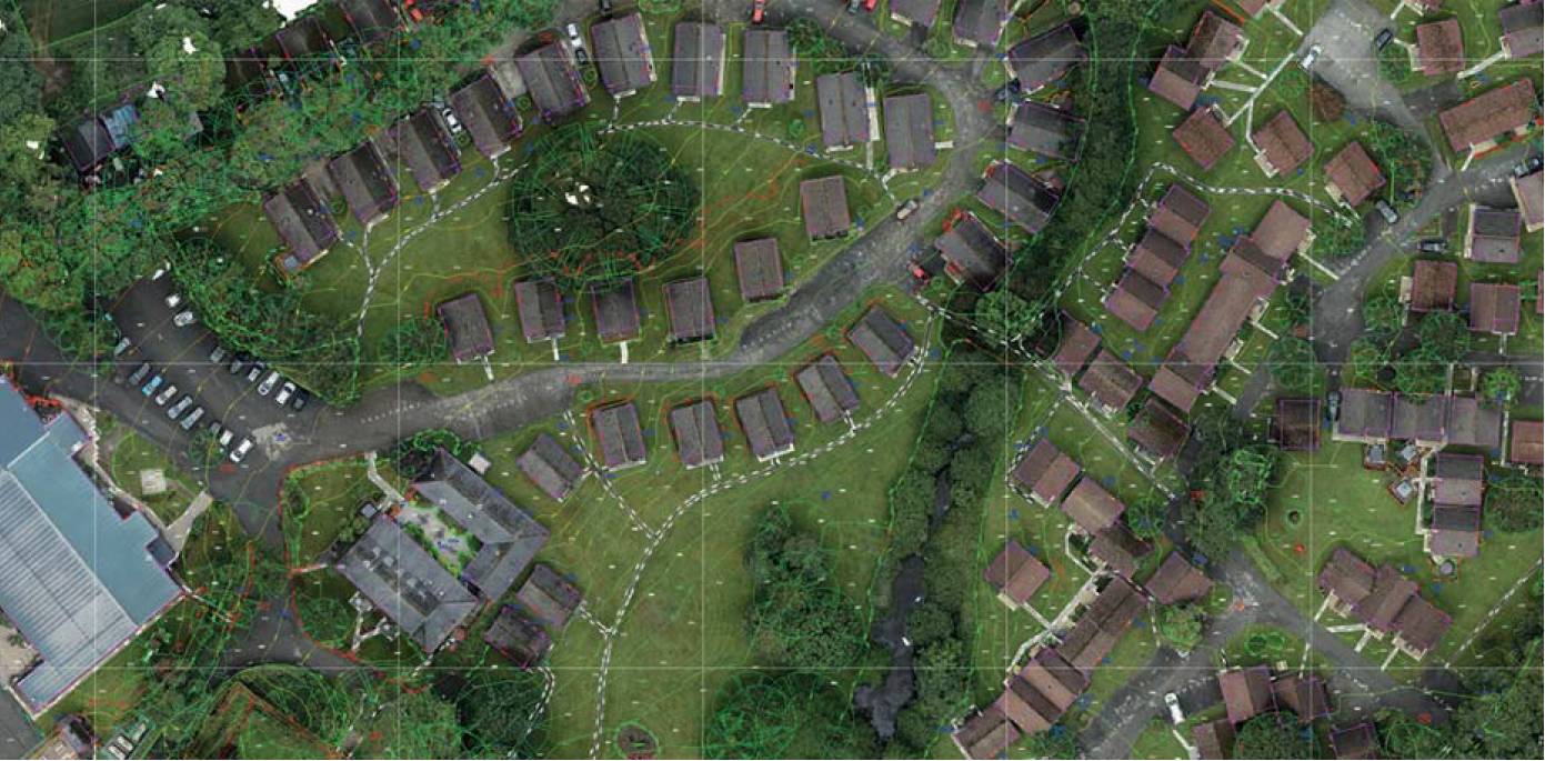
Combined aerial imagery and survey data.
Challenging sites and a tight schedule
With headquarters in North East England, Three Sixty Group operates nationally through an expanding network of local offices and focuses on wide ranging expertise and commitment to innovative technology. These factors made it ideal for the surveys of the five holiday sites and the challenges they presented, namely:
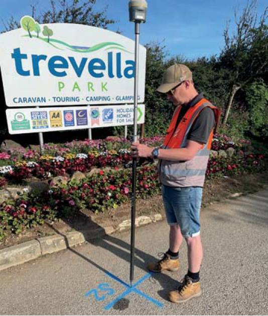
Three Sixty Group Director Neil Pollock with the TrimbleR12i.
- A limited time period of just eight weeks in which the survey work could be carried out before the start of school holidays.
- The scope of the survey and level of detail required including the accurate position of every static caravan and chalet and all the attendant utilities for each plot, usually located alongside the edge of the homes. Sites were typically 50 acres in size with around 300 plots on each.
- A natural environment which meant that the sites were often in remote locations, surrounded by trees and dense vegetation.
- The extent of the sites could require three to four miles of walking each day with heavy instruments.
A specification for the job was drawn up with the bulk of the work being undertaken by unmanned aerial systems (UAS). However, with the variety of assets to be recorded and the heavy tree canopy on most of the sites, there was a concern that the additional information required to infill the areas that the UAS data could not cover might prove extremely time consuming to collect if multiple total station set-ups were required in any areas where a GNSS lock could not be achieved.
An innovative solution
Three Sixty Group recently acquired two Trimble R12i GNSS systems from UK distributor KOREC. The R12i uses Trimble ProPoint which can process multiple constellations and signals for a superior performance (around a 30% gain) in degraded GNSS conditions such as under tree cover and up close to the sides of the chalets and caravans. It also utilises no-calibration TIP Tilt compensation. This technology avoids the need to plumb the pole for every measurement, again particularly useful in this case for recording utilities near the chalets and caravans where it would be time consuming to ensure the pole was always vertical.
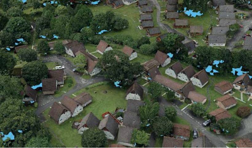
Blue areas indicate where the drone did not pick up data.
The R12 is GNSS was used with TrimbleTDC600 data loggers running Access software and corrections were achieved through the VRS Now real-time service. This eliminated the site time it would have taken to set up a base station and also removed any risk of a base station being moved or stolen.
Changing attitudes to GNSS
Following the project’s completion, the aerial imagery and R12i GNSS and S7 total station data were combined to create a single, comprehensive, topographical survey with additional plans and elevations of any buildings. On average, an estimated 40% time saving each day was achieved and was at a period of the year when tree cover is at its most dense. Use of the S7 total station was cut to the bare minimum and that also saved extensive time in avoiding set ups. This was particularly in evidence when recording the positions of the static caravans which are often in a fan formation. The technologies within the R12i completely changed the attitude and approach to surveying with GNSS – it is now being used in conditions that would never have been considered previously, making the company more efficient in the field.
The work was completed with one final piece of innovative technology; using a Trimble X7 3D laser scanner to survey the site club houses.
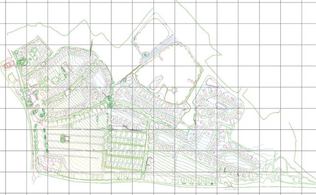
Finished drawing.
Lucy Hamilton, KOREC
www.korecgroup.com ww.360hq.co.uk
Thanks to Neil Pollock, Director, Three Sixty Group, for supplying the information and images for this case study.