THE FOREFRONT OF INNOVATION
A deep dive into the modern methods used by Ordnance Survey
Great Britain’s national mapping service, Ordnance Survey, has been part of the country’s DNA for centuries. Dating back to 1745, OS traces its roots to military strategy, where its services were originally utilised to survey England’s vulnerable southern coasts.
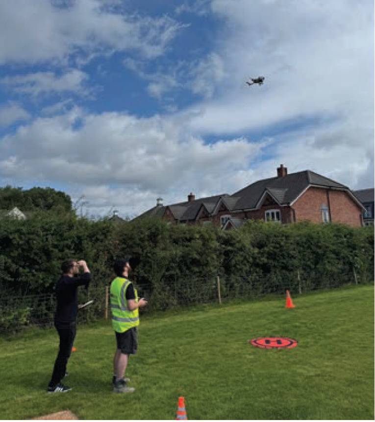
Deputy editor Mark Griffith observes the controlled takeoff of the drone with UAV pilot Harvey Clarke.
As the decades progressed, the demand for maps of increasing accuracy and scale grew and the technology to deliver them, including new methods of mapmaking and photography, grew in step.
These advancements continue to gather at a pace today, with the agency now having a hand in managing climate change risk, helping more people to enjoy healthier lives and connecting them to public services, with its location intelligence an essential ingredient to achieving a greater understanding of the future and the shape of the places we live in.
To gain a deeper understanding of just how advanced OS’ methods are today, CES joined Martin Howarth, production manager for surveying and editing and unmanned air system (UAS) pilot Harvey Clarke on a site in Manchester, UK, to observe how drone technology is used to gather geospatial data of new construction developments.
The drone’s positioning is assisted with a connection to OS’s internal NRTK correction service based on OS Net, and utilising GPS and Galileo satellites, with smart positioning preventing it from moving without input from the pilot, even taking wind speed into account.
Observing the survey in real time on a new build housing estate, the two went into detail about the use of advanced data capture techniques for surveying and mapping, highlighting the transition from traditional methods to modern technologies like GNSS receivers, total stations and drones.
Traditionally, a surveyor would have had to survey each building individually, manually capturing every point using lines and grids.
Although achieved in a similar fashion today, drone technology now takes a great deal of images from a number of angles, which can then be stitched together into a mosaic, with the aid of AI for change detection.
In essence, what would have been a job taking several hours or even days is now achieved in minutes. The images are then combined with captured ground control points and sent to an OS team in Southampton to be plotted manually onto the map, or to an external supply chain.
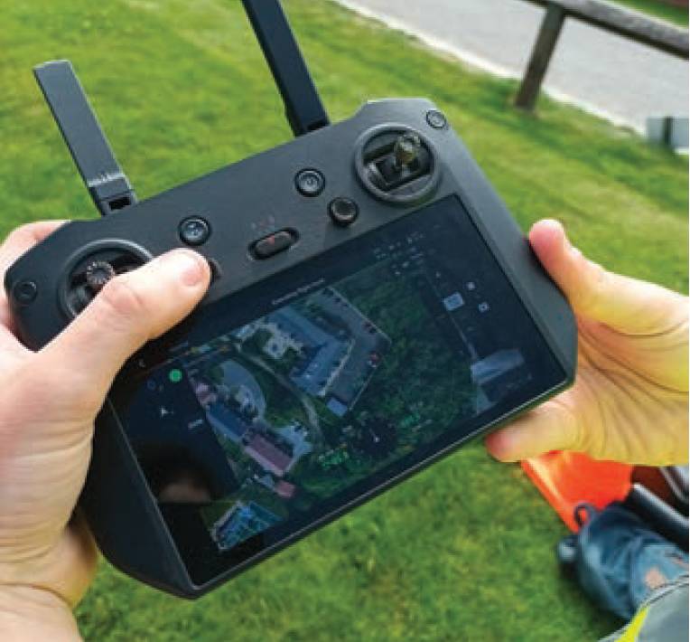
The UAV’s transmitter, from which pilot Harvey maintains control and ensures the flight plan is followed.
To ensure the images are captured in the right place and to eventually allow for an easier mosaic to be made, the flight path of the drone is programmed in, which it then follows automatically.
This flight plan involves taking nadir shots and moving in a zigzag pattern, which is paused if obstacles come into view or the pilot’s line of sight is obscured.
Additional oblique images are then manually captured to provide greater context for the plotting team.
The team uses network real-time kinematic (NRTK), a technology that improves GNSS accuracy for precise positioning for ground control points.
In the interest of maintaining the highest professional standards, UAV pilot training includes a week of self-led online courses and practical flight practice. Harvey’s training in particular involved in-depth self-directed instruction from an external training provider followed by a week of flight practice at OS headquarters in Southampton.
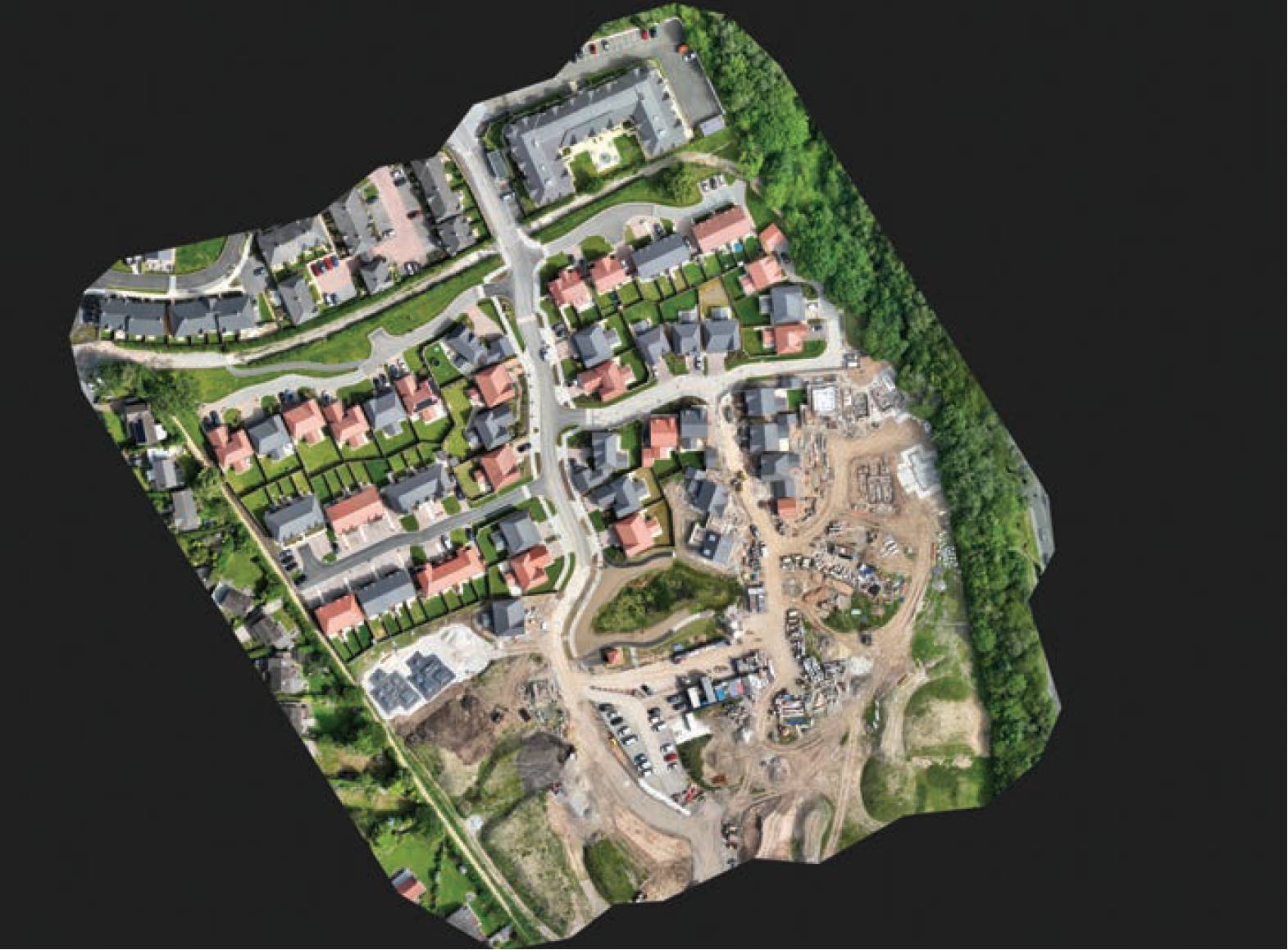
Orthomosaic nadir image file used for plotting of topographic detail. © Ordnance Survey
He was then tested in Wolverhampton through the training provider, which is accredited through the Civil Aviation Authority.
This thorough training is vital to the continued efficacy of OS; the operation of the drones themselves requires a great emphasis on safety protocols and a solid working knowledge of them, such as maintaining a 50m separation from pedestrians and cars and the ‘return to home’ function, which allows the drone to land itself if the pilot is incapacitated [note – this is 30m when taking off and landing].
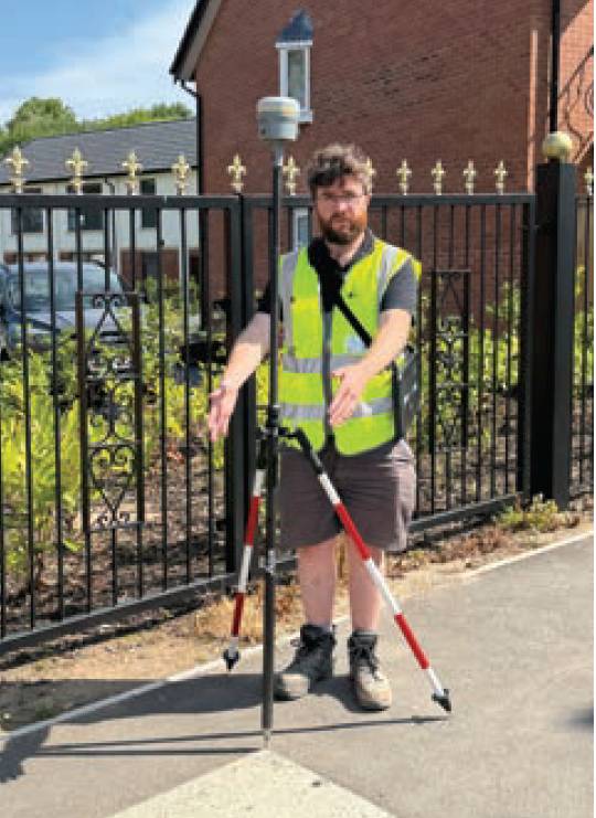
Once the drone completes its flight path, new ground control points are established.
The team also discussed the importance of avoiding overreliance on the technology – maintaining a line of sight and using specific drone colours for visibility are key to ensuring no accidents happen.
The drone’s positioning is assisted with a connection to OS’s internal NRTK correction service based on OS Net and utilising GPS and Galileo satellites, with smart positioning preventing it from moving without input from the pilot, even taking wind speed into account.
The Drone Desk platform, an operational and administrative application that handles a number of the drone’s procedures, is used to check weather conditions (flights are cancelled if winds exceed four metres per second). In addition, nearby airports, Manchester Airport in this case, have to be informed of any drone flights.
Harvey remains in frequent contact with to inform them of any UAV flights, putting in non-standard flight applications with air traffic controller NATS.
Once the flight plan has been completed and the aerial shots have been taken, checks are done for changes in the environment and new ground control points are captured using mapping technology ArcGIS for accurate imagery. Finally, the project’s data is transferred to a computer for processing.
The methods used today for gathering geospatial data are almost unrecognisable from those used at the organisation’s inception and it will come as no surprise when even this cutting-edge tech becomes obsolete in the near future. OS is determined to remain at the forefront of the industry’s innovative curve and will surely continue to innovate, implementing new technologies into its important work as and when they arise.