WHEN CONTEXT IS EVERYTHING
How a GeoDrone Survey helped a landowner pinpoint the exact proximity of an underground bunker to the Norfolk coastline
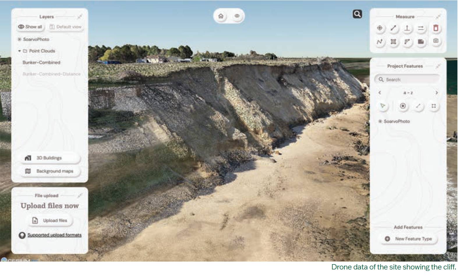
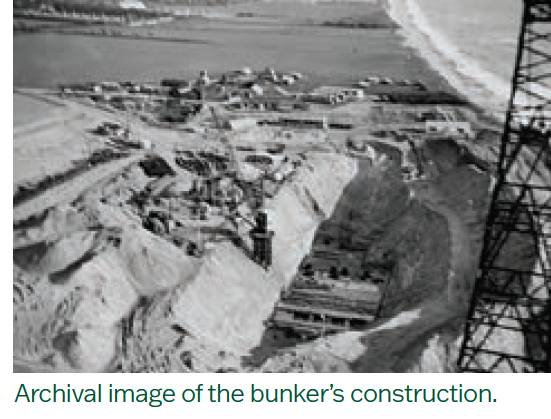
During the second world war, many bunkers were built across England, often underground, to serve a range of purposes from coastal defence and civilian protection to housing early-warning radar systems. One such structure lies beneath a private garden on the Norfolk coast. Keen to look after his assets and align with local council planning updates, the property’s owner set out to discern where the bunker lies and how close it is to the eroding cliff edge.
Departure Lounge Media Group, a company specialising in videography, photography, 360° virtual tours, long-term timelapse solutions for construction and drone services, was equipped to tackle the task, and was able to draw on the expertise of two partners from previous projects.
The challenge was to transform the various datasets into a clear, accessible deliverable – one that showcased the detailed survey work and placed it in geographical context
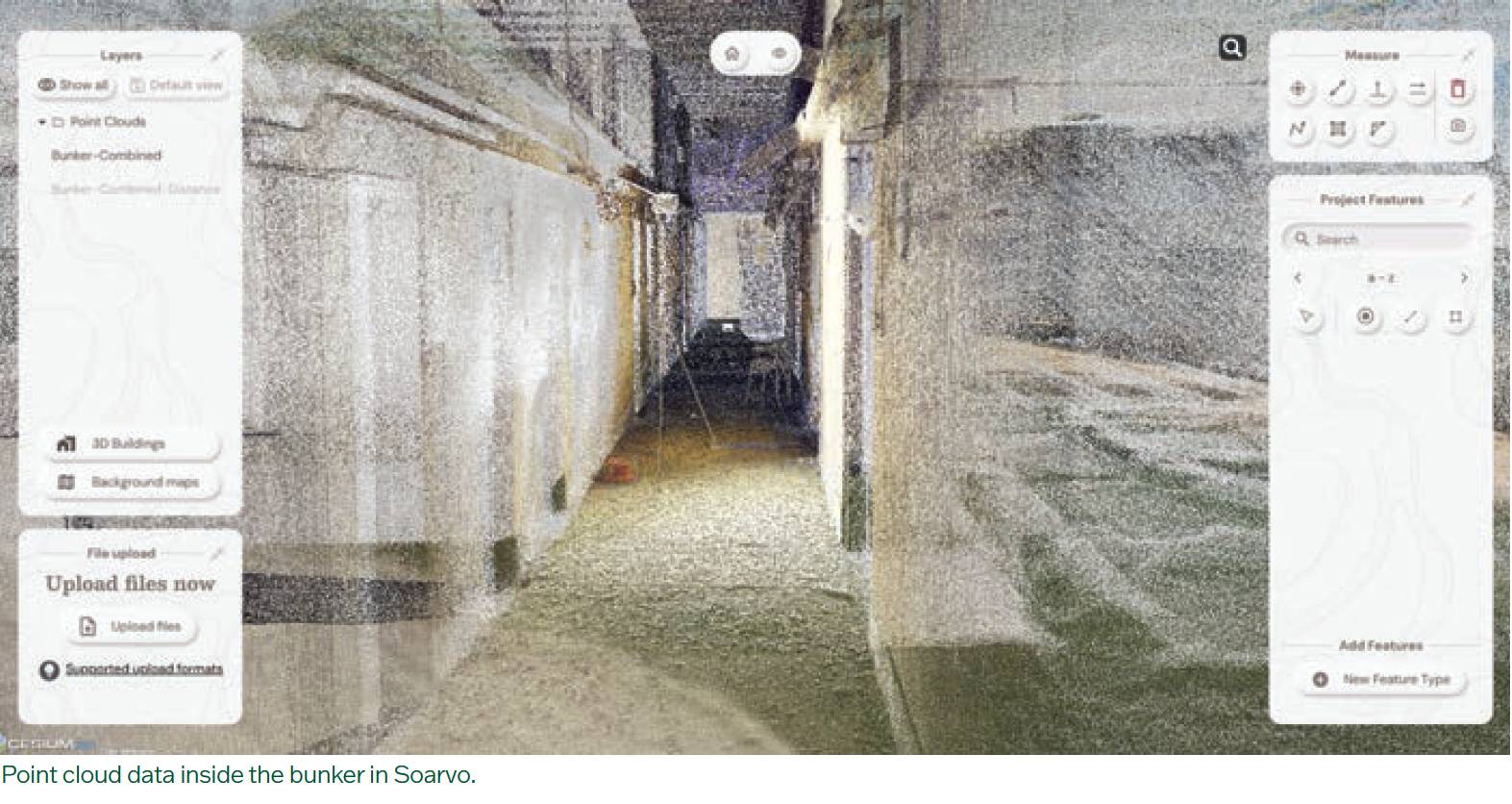
FlyThru – specialist in manned and unmanned aerial data collection – was responsible for all the survey work, above and below the ground. This included an underground survey of the bunker, which had never been accurately mapped due to collapsed sections. A confined-space drone, protected by a cage, was used to navigate the semi-blocked areas safely.
At ground level, a baseline survey was conducted to establish control points. 3D laser scans were also undertaken, with particular reference to the tunnel entrance, to help tie together the above and below-ground data. Ground control points (GCPs) were also established for traditional photogrammetry and to ensure accuracy across the datasets.
GeoDrone – a company that offers a variety of solutions spanning the data acquisition, processing and analysis sectors backed up by expertise in processing data to extract information tailored to clients’ requirements.
On this project, GeoDrone would be responsible for combining the datasets in a way that would allow for more interpretation than the originally planned deliverable of a PDF.
The challenge was to transform the various datasets into a clear, accessible deliverable – one that not only showcased the detailed survey work but also placed it in geographical context and addressed the landowner’s key concerns.
The value of the dense point cloud data lay not just in its quality, but in how easily it could be viewed and understood, particularly by third parties, without the need to invest in software licences or costly hardware. Soarvo, a platform developed by a KOREC sister company, provided a simple, cloud-based solution to visualise and share complex geospatial information without adding technical barriers.
Soarvo allows data from a range of sensors to be uploaded, processed, visualised and shared in one platform and for this project, it was the clear choice. After receiving the processed data from FlyThru, it was uploaded using a straightforward drag-and-drop procedure to allow work to begin immediately.
With the project now complete, the survey not only confirmed how close the bunker lies to the cliff edge, but also revealed inaccuracies in earlier surveys, which had misrepresented the bunker’s size and scale.