Laser Scanning
High level and accurate laser scanning at Nottingham County Hall
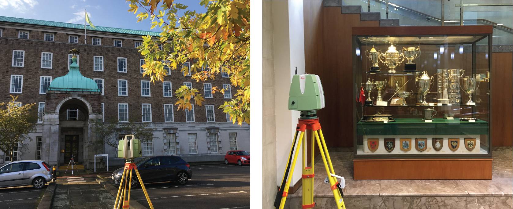
NOTTINGHAMSHIRE County Hall, located on the south bank of the River Trent at West Bridgford in Rushcliffe, England, serves as the headquarters of Nottinghamshire County Council, the upper tier local authority with jurisdiction across the whole of Nottinghamshire, with the exception of the city of Nottingham itself.
During much of the 20th century, the county council was based at the old Shire Hall in the Lace Market in central Nottingham. After deciding that the existing premises were inadequate for their needs, county leaders decided to procure a new building, the site they selected had previously been occupied by the Castle Cricket Ground. The foundation stone was laid in 1939, with construction completed in 1954 due to delays caused by the Second World War.
The council approached Survey Hub with a project scope to create a highly detailed digital 3D Revit model of the County Hall building. The model needed to be both accurately measured via laser scanning techniques, as well quickly captured within a window of opportunity for access whilst the building was scheduled to be vacated. The survey need to include the building modelling, topographic survey and underground utility information within the end product, so that the client had a digital representation of the site within Revit.
Down to the smallest details
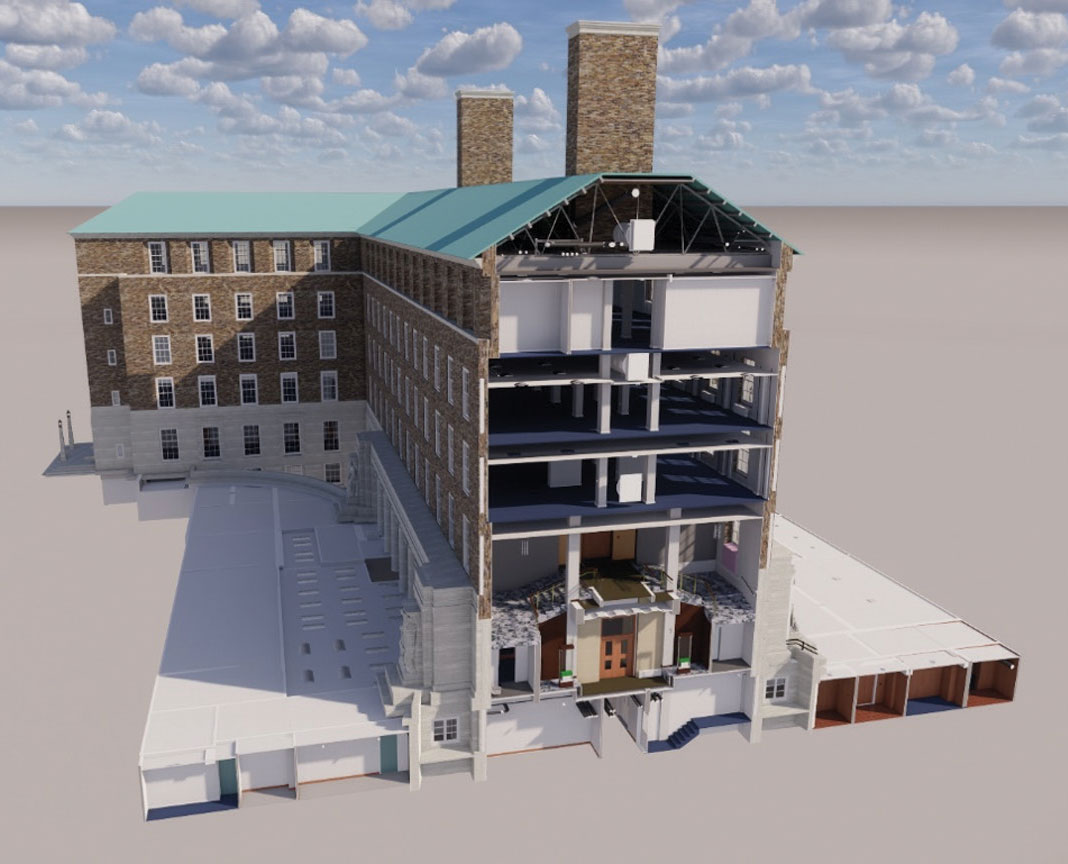
Survey Hub knew the project specification was to provide a Revit model of the Nottingham County Hall building in high detail. This included the architrave beams and material finishes, thus it required laser scanners that not only had the ability to colour the point cloud, but also to capture detail in good quality to enable the modelling team to extract the required detail.
It also needed to capture the required data as quickly as possible, working to the tight time frames set by the council to work whilst the building would be unoccupied.
To overcome the challenges of the project, Survey Hub utilised a pair of Leica ScanStation P-Series laser scanning solutions.
Two members of the Survey Hub and Leica teams completed an external traverse loop around the building perimeter with traversed stairwells and cross braces throughout the building floors. Whilst this was being completed, extra team members proceeded to capture the detail with the P-Series scanners.
Once all the traverse scanning was complete and registered using Leica Cyclone CORE, the team linked the scan data back to the original traverse system to ensure accuracy remained high.
The P-Series has a dual axis compensator which stands the survey team in good stead for accurate registration. To ensure the data was captured quickly to the level of detail required, the team utilised the I-Star bolt on.
High speed, high quality
An innovative combination of advanced time-of-flight range measurement, plus modern waveform digitising (WFD) technology enables the P-Series to achieve ultra-high scan speeds and low-noise performance at extended range (to 120m). Together with high-accuracy angular measurements and survey-grade tilt compensation.
The P-Series is ideal when very short time windows are available for capturing high-definition survey data or when ultra-high density, full dome scan data is needed. The P-Series features a valuable check-and-adjust capability, a simple procedure that can be completed within minutes. This improves system reliability and accuracy, helps fulfil the ISO standards and completes the work with greater confidence. For organisations such as Survey Hub, who need to add point cloud data to their process, Leica Cyclone creates all of the deliverables needed and serves them seamlessly throughout the project.
A view to the future
With the success of the project, Survey Hub has now purchased an RTC360 LT. This will enable surveyors to continue to utilise their existing P-Series scanners for the purposes of external and internal traverse loops and cross braces, whilst infilling data capture on large projects with the RTC360 LT.
Simon Hall, Leica Geosystems, with Lee Stevenson, Director, Survey Hub Hexagon
www.hexagon.com @HexagonAB www.surveyhub.co.uk