From data to action
Tom Parry, Global Lead for Coastal Resilience, and Paul Seaton, Director of Hydrography and Coastal Resilience, Fugro

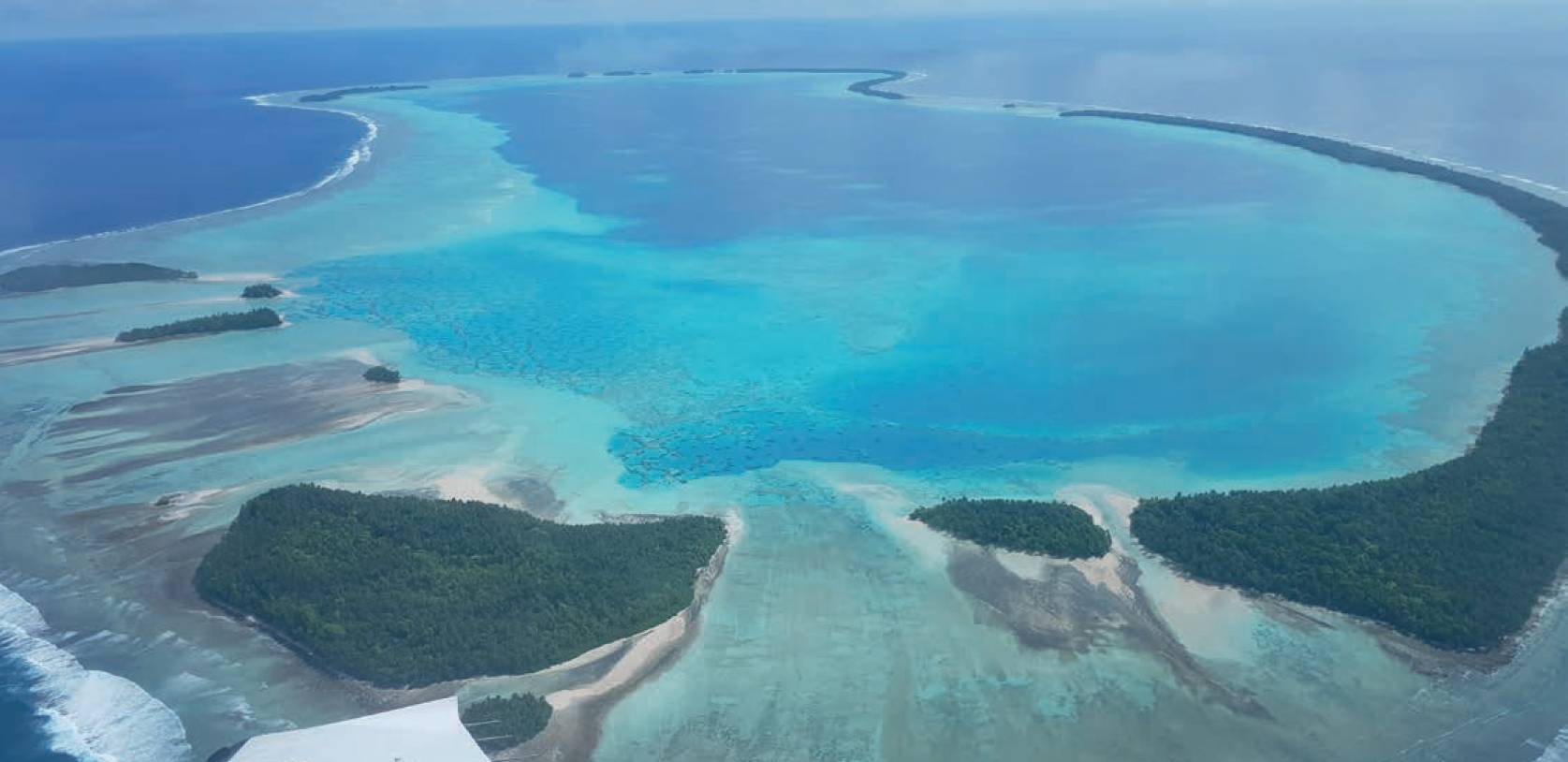
Airborne lidar capture over the Tuvalu Islands.
Building robust climate adaptation strategies with the power of geo-data
IN a world where climate change is amplifying physical risk, harnessing the power of geo-data is no longer an option; it’s an imperative. With greater access to accurate, real-world insights, government decision-makers can craft effective strategies, fortifying coastal resilience to not only safeguard communities but also to ensure the safety of infrastructure and the protection of natural capital.
Coastal impacts of climate change
In a world where climate change is amplifying physical risk, harnessing the power of geo-data is no longer an option; it’s an imperative.
Many of the world’s coastlines host thriving communities with bustling hubs of human activity; countless coastal environments support busy ports and vibrant natural ecosystems.
But coastal regions are facing significant challenges through compound effects as they suffer the consequences of climate change – rising sea levels, more frequent and severe extreme weather events, storm surges, wave effects, flooding, landslides, land loss and soil and ground water salinisation.
In some low-lying areas such as the Pacific Islands, the lives, livelihoods and living ecosystems that form global coastal societies are already in jeopardy. The potential to devastate existing critical infrastructure is very real, driving growing concerns for banking and insurance groups over the physical and economic impacts of these risks.
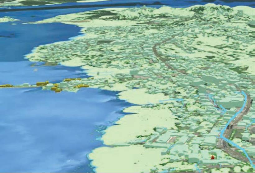
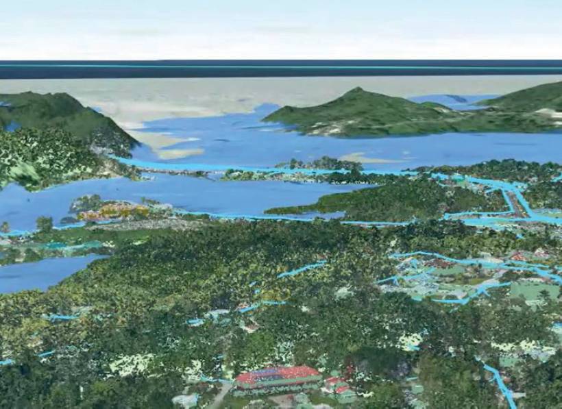
 Testing the application of lidar derived decision making products in the VirGeo digital lab.
Planning for uncertainty
For coastal management authorities around the world, climate adaptation planning is a vital step in developing robust and sustainable strategies to contend with the growing physical climate risk. The process is complex and often frustrating and requires authorities to consider a broad range of issues and stakeholders.
It can take years – even decades – to develop, fund and implement with governments globally at varying levels of readiness and adaptive capacity.
Overcoming planning challenges
Coastal regions are facing significant challenges through compound effects as they suffer the consequences of climate change – rising sea levels, more frequent and severe extreme weather events, storm surges, wave effects, flooding, landslides, land loss and soil and ground water salinisation.
A vital move in overcoming some of the challenges to planning has been the improvement of access to and integration of geodata, particularly high-resolution lidar and satellite-based earth observation data products.
Decision-makers often have other priorities and trying to understand long scientific reports can be a barrier to progress. Data-driven insights that non-technical users can understand and trust, together with data visualisation tools, are helping to communicate the story behind why people should care.
Uncertainty around future scenarios requires an adaptive approach that can be difficult to fund and plans often sit on shelves not being implemented. Reducing uncertainty with accurate geo-data is key to providing the right level of confidence to decision-makers and unlocking funding.
Investing in data – supporting informed decisions
Climate adaptation management is locally complex, and it needs to remain a living process across multiple years, while maintaining accurate and cost-effective strategies. Planning for coastal resilience is vital but this cannot happen without a thorough understanding of the risks and hazards associated with climate effects.
Early investment in high-resolution geo-data can empower governments to develop and implement sustainable and actionable coastal management plans.
Through Fugro’s VirGeo, a web-based geo-data engagement platform, Fugro is also exploring how the application of data can be improved for coastal communities around the world. Lidar data holds a significant amount of value which Fugro can unlock. Through its digital lab co-design process the company has been working with the Pacific Islands to explore ways to support land use planning and advanced data-driven modelling.

Leveraging high-resolution spatial geo-data
A vital move in overcoming some of the challenges to planning has been the improvement of access to and integration of geo-data, particularly high-resolution lidar and satellite-based earth observation data products.
Future planning and management rely upon critical baseline data to understand the multiple components of land use and risk analysis required to develop robust climate adaptation strategies.
A crucial development in support of coastal resilience modelling has been the integration of topographic and bathymetric data, which was demonstrated by the United Nations Development Programme Tuvalu Coastal Adaptation Project as a game changer in the Pacific areas.
Although its value is often only realised in hindsight, accurate geo-data is key to significantly improve planning and adaptation design to protect our coastal societies, through cost reductions or smarter spending. And while the cost can be perceived as relatively high, the resulting data regularly delivers value that far outweighs it.
Valuable insights for the Government of Tuvalu
A crucial development in support of coastal resilience modelling has been the integration of topographic and bathymetric data, which was demonstrated by the United Nations Development Programme Tuvalu Coastal Adaptation Project as a game changer in the Pacific areas.
With its credentials in technical innovation and the delivery of insights from geodata, Fugro has helped decision-makers to make sense of changes and risks in coastal environments around the world.
So when the Pacific Ocean nation of Tuvalu, a group of nine low-lying atolls and islands, needed survey data to support critical engineering decisions, it was Fugro that acquired the data, provided the analysis and delivered modelling and access to digital workflows and interpretation.
Lidar surveys provided a safe and effective way to capture large amounts of data to measure land elevation and sea depth. Using a powerful laser to measure distance from an aircraft, each flight captured 30 to 40 km2 of highly accurate data at depths of penetration up to 80m.
For the simultaneous collection of above- and below-water survey data, topographic and bathymetric lidar systems were installed on the same aircraft, allowing the relationship between land elevation and sea level to be modelled. Vulnerable areas were pinpointed so that the smallest of changes can be monitored through recurring data captures, enabling potential hazards to be identified at the earliest opportunity and mitigation measures swiftly implemented.
High-resolution survey data enabled the creation of the baseline map that now allows the Tuvaluan Government to understand exactly how the islands’ coastlines are changing as a result of coastal erosion and climate change. But the opportunity to use geo-data for projects like this does not end here.
Palau’s first topographic lidar base map
Coastal and island communities, whether in the Pacific Ocean or elsewhere in the world, are situated at the very forefront of climate change.Around 5,000km from Tuvalu, in the western Pacific Ocean, is another of the many low-lying archipelagos. The nation of Palau consists of some 340 coral and volcanic islands that are suffering the same impacts of climate change.
Recognising the fundamental role of spatial data in planning for climate resilience, the country’s government, in partnership with the United Nations Development Programme, also selected Fugro to undertake its first ever digital coastal survey exercise, using state-of-the-art lidar technology.
The project commenced in April 2021, when David Idip of the Palau Automated Land and Resource Information System announced that the data will not only help with Palau’s disaster management capacity but will also play an important role in sustainable development and natural resource management.
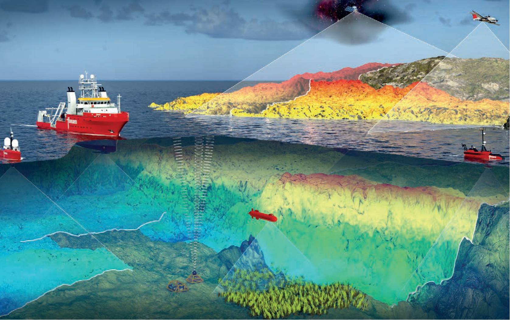
 Fugro's high speed hydrography solution capabilities
A new approach in Northern Ireland
The impacts of climate change are intensifying, and coastal environments are changing in ways that our ancestors could never have foreseen. Leveraging geo-data has never been more critical and early investment in that data is empowering governments to develop and implement sustainable and actionable management plans.
Coastal and island communities, whether in the Pacific Ocean or elsewhere in the world, are situated at the very forefront of climate change. Impacts suffered in Northern Ireland, including flooding and an increase in the rate and extent of coastal erosion, prompted the Department of Agriculture, Environment and Rural Affairs (DAERA) to seek a greater understanding of how the coastline is changing and a better way to manage it sustainably.
The 763km coastal stretch, from Lough Foyle in Londonderry in the north to Warrenpoint in the south, comprises dramatic cliffs and long, sandy beaches. DAERA needed to know the areas which would be most impacted by sea level rise, and where storms would cause the most harm. So Fugro was commissioned to deliver a 3D elevation model to underpin a new approach.
To build up a morphological picture of the coastal environment, various methodologies were selected. Satellite-derived bathymetry (SDB) data was used to map the intertidal area, to a depth of approximately 10m, and a topographic lidar survey acquired data from the intertidal area to approximately 200m inland.
Data were even included from the so-called ‘white ribbon areas’ by using proprietary RAMMS technology (rapid airborne multibeam mapping system). Collecting geo-data from this ‘dead zone’ is notoriously difficult as it’s beyond the reach of terrestrial systems and the shallow water prevents data collection by conventional marine survey vessels.
The resulting baseline data will enable Northern Ireland’s scientists to build a morphological picture, repeating lidar surveys every three to five years and providing a much better understanding of how the coastline is changing and enhancing its natural resilience.
A critical investment
The impacts of climate change are intensifying, and coastal environments are changing in ways that our ancestors could never have foreseen. Leveraging geo-data has never been more critical and early investment in that data is empowering governments to develop and implement sustainable and actionable management plans. Plans that support coastal resilience to preserve the lives, livelihoods and living ecosystems that form our global coastal societies.
Tom Parry, Global Lead for Coastal Resilience, and Paul Seaton, Director of Hydrography and Coastal Resilience, Fugro
VirGeo is a registered trademark of Fugro.