How geospatial technology can help the finance sector address biodiversity ambitions
Alicia Williams, Geospatial and Remote Sensing Engineer, Maxar
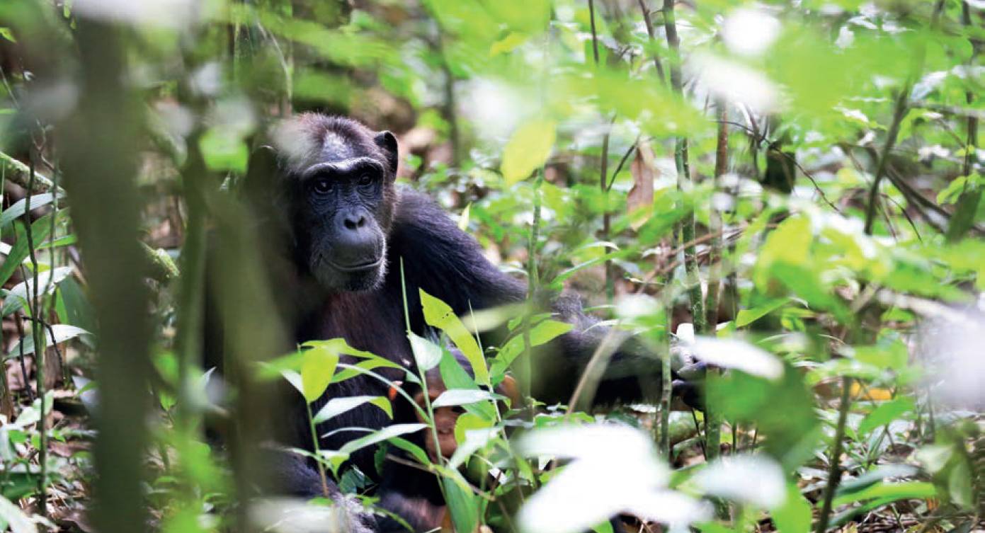
Male chimpanzee hiding in the Kibale Forest National Park in Western Uganda. Image credit: JordiStock.

A new WWF and Maxar report showcases how geospatial technologies can play a role in helping to validate corporate biodiversity performance
THE global finance sector is hyper-focused on enabling better environmental, social and governance (ESG) outcomes for business, leveraging its influence to make more environmentally minded investment decisions, encourage more corporate action and enable progress at scale. Recently, there’s been a particularly heavy emphasis on biodiversity, which has become one of the hottest topics on the global ESG agenda.
In this push, the finance sector needs more transparency and visibility into the biodiversity-related impacts of business. A new report authored by the World Wildlife Foundation (WWF), in partnership with Maxar, outlines how geospatial technologies can play a differentiating role in helping deliver the data and ground truth insights needed to validate corporate biodiversity performance.
The report, titled ‘The Biodiversity Data Puzzle’, provides for the first time an in-depth exploration of how geospatial imagery and analytics can be used to measure nature-related impacts of business and recommends several action items to help better leverage these technologies to drive progress. Maxar served as the technical contributor for the remote sensing industry, helping define the various use cases and applications.
To bring this topic to life, we have highlighted three examples of how geospatial technology is being used today to better measure and support biodiversity initiatives. Though not examples from the finance sector, these stories underscore the value of Earth observation in monitoring biodiversity impacts of business and society.
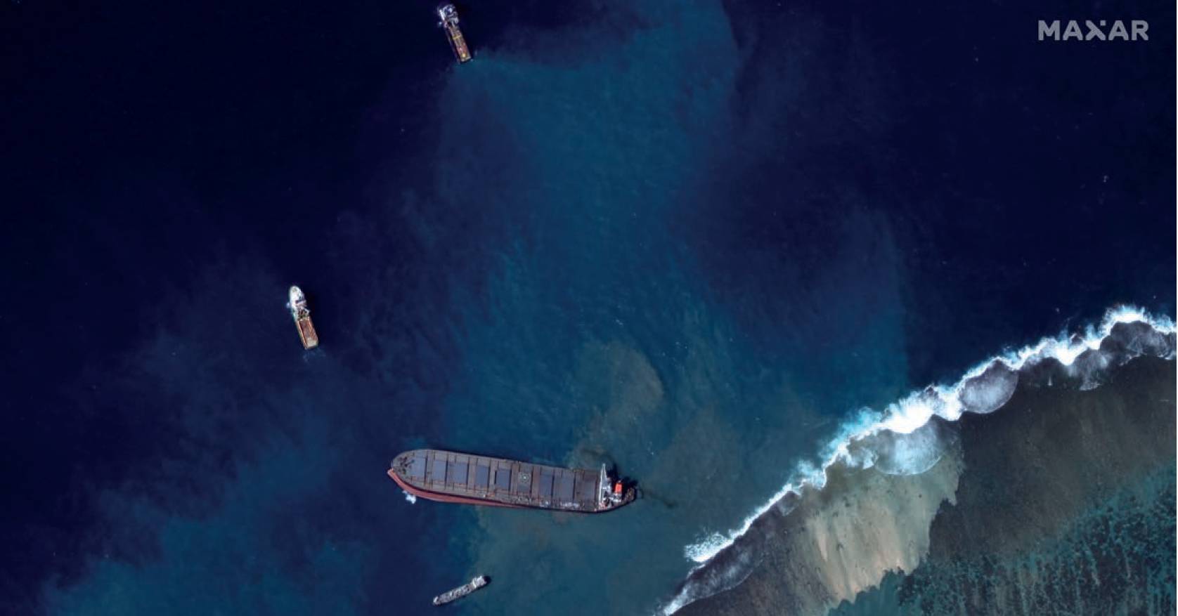
This Maxar WorldView-2 image shows the MV Wakashio ship on 12 August 2020, after it ran a ground and started leaking oil on Mauritius. Image courtesy of Maxar.
Wildlife population mapping
Maxar’s technology has been used by partners around the world to help map wildlife populations, particularly vulnerable species that are being impacted by climate change. For example, researchers from the University of Bath and the University of Oxford in the UK used Maxar’s imagery and their custom algorithms to detect elephants from space with comparable accuracy to human detection capabilities.
Recently, there’s been a particularly heavy emphasis on biodiversity, which has become one of the hottest topics on the global ESG agenda.Other researchers have used similar approaches to count whale populations, particularly in remote parts of the ocean. We’ve also engaged in initiatives that showcase the power of making geospatial data available to the public. For the past two years, we’ve partnered with WWF and the British Antarctic Survey in a crowdsourcing effort to detect and count walrus populations in the Arctic, leveraging our GeoHIVE platform.
These initiatives are all inspiring examples of how geospatial data can help support wildlife management and conservation efforts.
Mapping natural habitats around the world
Geospatial data can provide important insights into the health of critical natural habitats such as forests, mangroves and more.
Long-time Maxar Purpose Partner, Jane Goodall Institute, uses Maxar imagery to map forest habitats in Uganda that are critical to the survival of chimpanzees and to the health of local communities. This land has historically been heavily affected by logging, agriculture, mining and development activities, and through a series of mapathons, Maxar mapped about 9,000km2 of forest in the region, identifying wooded areas, roads and other important markers.
Geospatial data can provide important insights into the health of critical natural habitats such as forests, mangroves and more. Space-based imagery can help stakeholders understand how these events impact local wildlife populations or habitats, helping identify risks that require close attention.
Maxar has helped other customers and organisations with similar efforts in Europe, Australia and elsewhere.
Monitoring specific impacts of human activity
Geospatial data can be particularly useful in providing transparency around the impacts of human activity, both for specific events and activity over time. For example, Maxar has previously made geospatial data available to non-profit organisations and others to help with remediation efforts for events like oil spills.
Space-based imagery can help stakeholders understand how these events impact local wildlife populations or habitats, helping identify risks that require close attention. Maxar has also helped organisations like our Purpose Partner, Amazon Conservation Team, monitor illegal mining in the Amazon Rainforest, mapping new activity and providing authorities with insights on when and where they need to take action.
Additionally, Maxar’s WeatherDesk developed a way using high performance compute to create weather forecasts 58% faster than the National Oceanic and Atmospheric Administration (NOAA) supercomputer, and these timelier insights can enable humans to take action to prevent or lessen potentially harmful impacts on nature.
These are just a few examples of how geospatial technologies are helping monitor nature-related impacts of climate change and human activity today, and they provide inspiration for how sectors like finance can apply these technologies to better achieve their ESG and climate ambitions.
Alicia Williams, Geospatial and Remote Sensing Engineer, Maxar
To read the full ‘The Biodiversity Data Puzzle’ report, visit www.wwf.org.uk/our-reports/biodiversity-data-puzzle