Uncovering the answers
Lucy Hamilton, KOREC Group
ANGLIAN Water is the largest water and water recycling company in England and Wales by geographic area. The company prides itself on doing the right thing and is always exploring innovative ways to protect the region and the communities it serves from perennial problems such as flooding and discharges. One of the areas of work the company has been focussing on in particular, in the last 12 months, is the causes of flooding.
Because identifying the many potential contributing factors responsible for this, can be a complex issue.
Data-led approach
Using software and hardware from KOREC Group and Trimble, the companies’ client, Anglian Water, felt that this problem, although not unassailable, needed a new approach if the company was to provide the high level of service. A final push came in 2021 when heavy rain flooded a catchment area of around 60 homes in a location that had caused a number of complaints over the years.
Previously, floods in this area had been tackled in several ways including a replacement pump, a change in the frequency of the pump regime and jetting. However, nothing had solved the problem despite numerous site visits.
Previously, floods in this area had been tackled in several ways including a replacement pump, a change in the frequency of the pump regime and jetting. However, nothing had solved the problem despite numerous site visits. Following the most recent flooding incident, the client was determined to explore all potential causes and remedy the problem once and for all. While in the past, the client had used CCTV and checked its own assets such as sewers and pumps, it was agreed that if a solution was to be found, the team needed to collect centimetre positions, images and attribute information on all the factors that could contribute to the situation.
This included those not owned by Anglian Water, such as council-managed ditches, private sewers and water courses.
System criteria
The client felt that although this data-led approach would bring the answers it was looking for, as a new strategy it would also have to be cost-effective and deliver results quickly. It also needed to be easy to use as the team who would use the software and hardware were not engineers or surveyors, as well as use a system with customisable software that would make it suitable for other applications.
A Trimble Catalyst DA2 GNSS system was used with KOREC field data capture software to provide centimetre positions to supplement their primary area of work rather than positions for all-day, everyday use. Used with a subscription service of either 1cm, 10cm, 20cm or 60cm, accuracy, the client selected the Trimble Catalyst DA2 GNSS system with its receiver providing 1cm accuracy over three months.
Connected to an Android or iOS device, it was able to turn it into a precision mapping, navigation, and measurement tool to use with any location-enabled app or service, with the client opting to process the captured data using KOREC software to do this.
Plus two Trimble TDC600 data loggers.
All in the detail
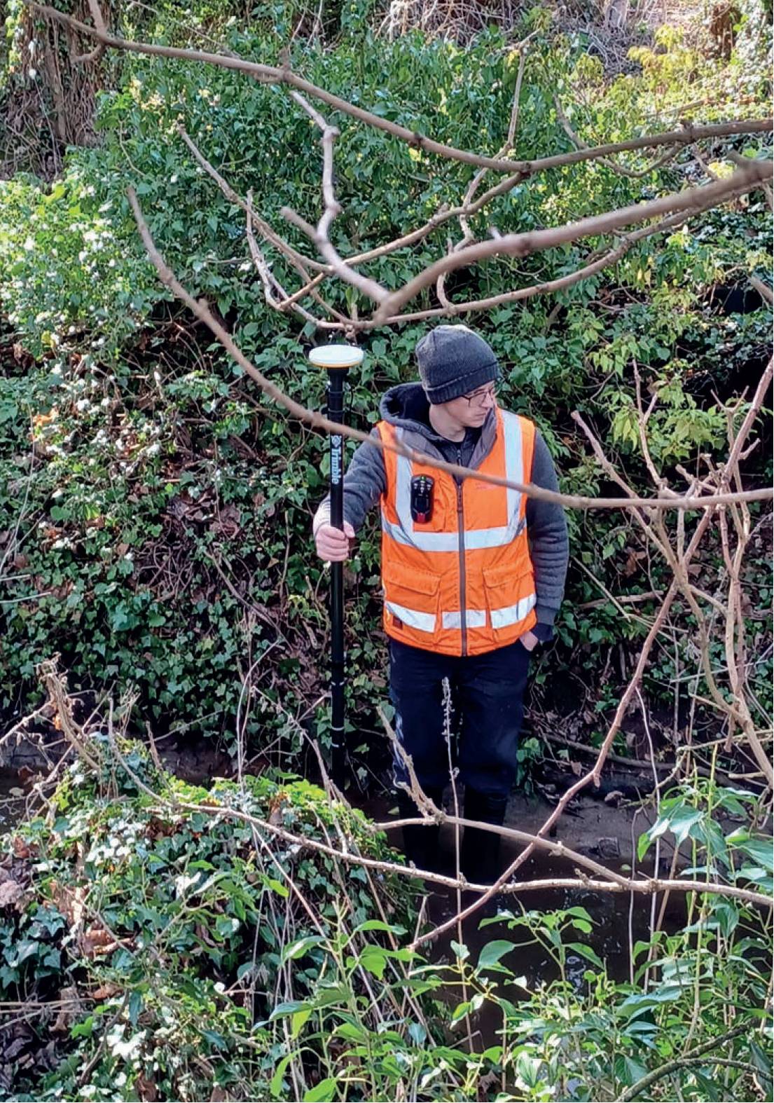
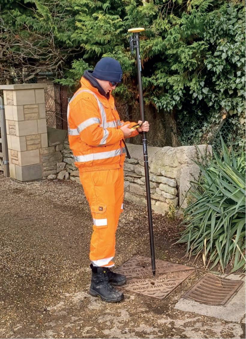
Revisiting the catchment with the persistent flood water, the teams used their two Trimble Catalyst DA2 systems to capture any detail in the area that could assist in their analysis of the flood, irrespective of who owned it. This included everything from manhole covers, gutters and roof connectivity to gullies, surface water and ditches. All the data was captured over a period of two days.
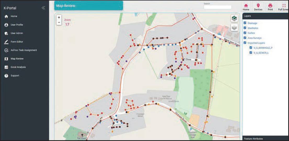
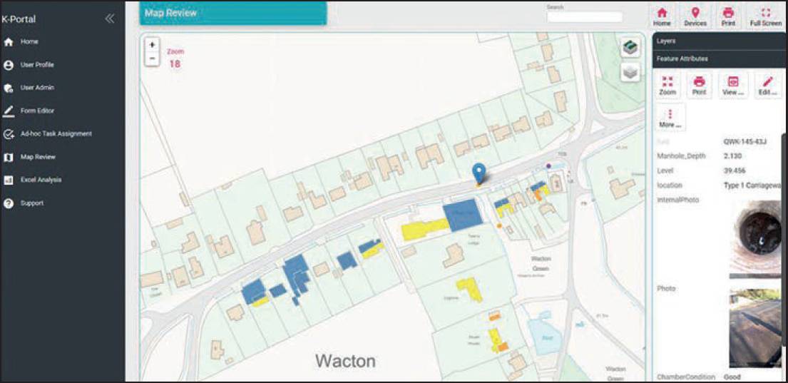
Revisiting the catchment with the persistent flood water, the teams captured any detail in the area that could assist in their analysis of the flood, irrespective of who owned it. This included everything from manhole covers, gutters and roof connectivity to gullies, surface water and ditches.This also saw them revisiting properties due to the absence of householders. The recorded data was automatically fed back to the KOREC Portal building a picture of every asset in the area.
As the data populated the portal, it quickly became evident that the problem lay not with sewers or pumps but with a blocked ditch at the side of the catchment that was not allowing surface water to drain off the roads.
This water was, instead, finding its way into the foul system by pooling over manhole covers. It had also resulted in people lifting these manhole covers to drain surface water off their gardens.
This information was fed back to the parish council who were then able to communicate the findings, backed up by the data, to the landowner.
It meant that due to this new data-led approach, the client had been able to solve a ten-year problem in just one week.
New workflow
The new workflow for tackling flood causes is now much simpler = Capture data –> analyse data in the portal –> make a decision –> present feedback to relevant parties for repair.
It is now possible to deduce the root cause of a problem significantly faster and solve long-term problems not only now but those of the future by proactively managing potential floods.
Lucy Hamilton, KOREC Group