
IN CONVERSATION WITH NICK BOLTON
Ordnance Survey’s tireless work is helping build a modern digital Britain
With its invaluable location data and survey expertise, the importance of Ordnance Survey to the modern-day geospatial ecosystem has never been more apparent. Mark Griffith recently sat down with OS CEO Nick Bolton to discuss the latest trends in the industry, and what we can expect going forward.
I have spent the last 20 years as a CEO of tech businesses, with lots of highlights from executing new growth strategies to leading the development of new products, including the creation of award-winning solutions used widely across visual effects, including for ABBA Voyage while CEO at Oxford Metrics. Currently, I lead Britain’s national mapping service, Ordnance Survey (OS), which has a rich history as a creator of paper maps. However, OS has evolved and today creates, maintains and provides location data relied on by government, businesses and individuals every day. OS is now a data powerhouse. This digital transformation journey means OS is a cornerstone of Britain’s geospatial ecosystem.
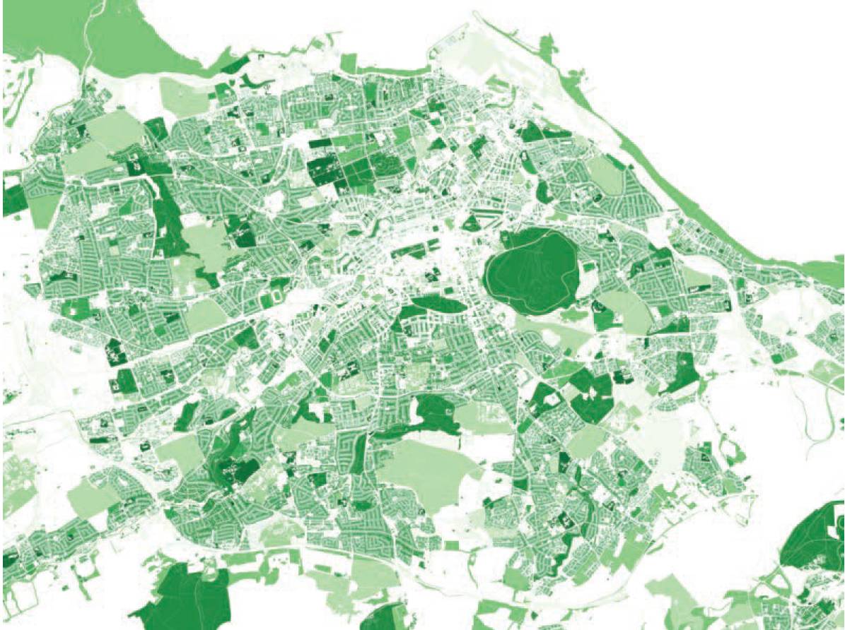
Setting the benchmark in location data that underpins public services, supports economic growth and enables people to lead healthier lives by encouraging outdoor activities. Everything happens somewhere. OS’s core expertise lies in understanding location. We are the custodians of the national map of Britain, which is so detailed that our trusted maps and location data connect Britain but also deliver immense value to the nation, supporting everything from housing, transport and logistics to utilities. The value of the data is in the insights it enables because data on its own is not enough.
Data intelligence is obviously a key focus for many business leaders, and we’ve seen an increased demand for insight derived from location data. OS has a critical role to play in the data-driven world of maps by helping to tell the story of the data, whether it’s showing population spread, pollution levels, prevalence of diseases or mapping out renewable energy frameworks. Wherever you look, most of the critical infrastructure that Britain relies on every day depends on OS. We continually embrace digital transformation, the latest example is incorporating AI techniques to analyse vast quantities of geospatial data quickly, by using automated feature extraction and detection. This enables us to meet customers and market needs by making changes and enhancements faster.
Producing high-quality, authoritative data builds trust, which is essential for sustainability reporting and confident decisionmaking by businesses and governments, helping to avoid reputational risks from inaccurate data.
Geospatial data plays a critical role in identifying areas at risk from climate change and supports planning to mitigate these changes. This data helps the financial services sector in risk management and sustainability efforts, supports the police with crime analysis and aids the transition to cleaner and green energy.
Producing high-quality, authoritative data builds trust, which is essential for sustainability reporting and confident decision-making by businesses and governments, helping to avoid reputational risks from inaccurate data. We exist within this large geospatial ecosystem but it is how we refine, distribute and apply data that supports better outcomes. This is why greater collaborative leadership from businesses, government, SMEs, policymakers and industry partners is crucial to improve data coverage and consistency.
Our market advantage lies in data creation and working with partners as part of the geospatial value chain so they can help convert that data into insights. VR technologies and 3D maps offer the potential to enhance work and creation, allowing businesses to simulate real-world scenarios. OS has already embraced this innovation with the augmented reality (AR) feature in OS Maps. This allows customers to visualise an area and explore their route in detail before setting off on foot or by bike.
Although the GenAI breakthroughs of the last couple of years are amazing, the tech industry, especially in the field of computer vision, has been using it for the past decade and that includes OS. Today, AI is widely used at OS, which is particularly applicable in areas including change detection and automatic feature extraction. GenAI offers a new set of opportunities for everyone, including us. At a high level two things really matter in AI; the training data and the algorithms used to train the networks. With our enormous dataset of 500 million features and our ongoing investment in AI skills and systems, we are well positioned to be a national centre of excellence in the practical application of AI.
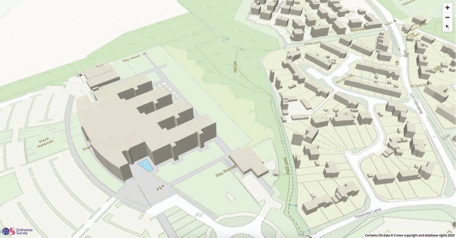
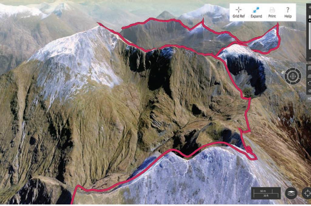
Positioning, navigation and timing (PNT) is fundamental to the geospatial industry. At OS we are passionate about the ‘positioning’ aspect, and this has been part of our DNA since 1791. From trig pillars through to our OS Net service, everyday OS captures Britain’s changing land and features to centimetre accuracy. Flying the length and breadth of Britain, we survey from above and process millions of laser scans to create 3D imagery, which is added to the National Geographic Database. Our data and the OS Net service are critical for applications such as autonomous vehicles, agriculture and smart cities, enabling precise navigation, efficient crop management, and seamless machine-to-machine communication. The critical importance of PNT will only continue to grow as technology advances, and OS is uniquely positioned to support innovation in these sectors, enhancing resilience and operational efficiency.
The PSGA is a contract between the government and OS that enhances the accessibility and usability of geospatial data for 6,500 public sector organisations. Through the long-term funding model of the PSGA, we have built the fundamental building blocks to expand and facilitate more applications of our data to remove any blockers. We release new data and enhancements every six months, with the latest data release including data for over 40 million roofs in Great Britain. The new data will benefit a wide range of sectors, from sustainability and energy, insurance and property to emergency services. We now hold regularly updated datasets and provide simpler and easier access to the OS National Geographic Database, allowing customers to personalise and download the specific data they need.
The PSGA supports government missions by providing accurate and authoritative data that informs decision-making. The agreement reflects a growing recognition of OS’s role as more than just a mapping agency, by positioning it as critical in supporting the mission-led government – growing the economy, building an NHS fit for the future, creating safer streets, providing opportunities for all, and making Britain a clean energy superpower.
For example, making Britain a clean energy superpower requires knowing the location of existing power infrastructure – where the transformers, interconnects and sources are, and how they relate to housing, businesses and the landscape. OS holds all of this information. Similarly, OS data can help plan where to build houses, ensuring the right infrastructure is in place to support those communities.
OS is committed to providing open data to support innovation and encourage the use of accurate location data. A large proportion of our data is open data while the premium data has a threshold limit meaning users can work and develop with the data without a cost. Plus, the PSGA enables all public sector users, whether central government or local government, to access the data free at the point of use. However, we don’t want to just put data out into the world. We want people to use it and have developed tools and partnerships to help grow the use of our data. Examples include a range of APIs in the OS Data Hub and the recent collaboration with Snowflake Marketplace, adding open datasets to its platform to make OS data more accessible to users.
All of which will unlock new opportunities for innovation by bringing the data to life through maps and other forms of visualisations, far beyond traditional spreadsheets and databases. We also drive innovation through communities like Geovation. Geovation, an Ordnance Survey initiative, supports start-ups by providing access to geospatial data, funding and expert advice. This enables start-ups to find solutions to current challenges underpinned by data that they wouldn’t otherwise have access to, driving innovation and tackling global social, economic and environmental issues.
At OS, we are the custodians of the national map of Britain, with half a billion features and 20,000 changes daily. OS ensures the accuracy of its data through a rigorous multi-checkpoint validation process. This process involves multiple layers of quality control, including automated checks and manual reviews by expert teams. The organisation continuously evaluates and adapts its validation methods to maintain high standards of reliability and accuracy. By incorporating feedback from users and leveraging advanced technologies like machine learning, OS can improve its processes and ensure that the data provided is up-to-date and accurate. This commitment to quality and precision is fundamental to delivering reliable geospatial data to our customers.
By incorporating feedback from users and leveraging advanced technologies like machine learning, OS can improve its processes and ensure that the data provided is up-to-date and accurate.
OS has been appointed future operator of NUAR, which will be incorporated into the National Mapping Service’s public task from spring onwards. It’s easy to understand the mapping requirement of what’s above the ground. We’ve got to remember there’s an awful lot that’s below the ground. To give you an idea of the scale, there are four million kilometres of pipes and cables underneath the ground.
Now compare that to the 400,000km of road that we’ve got above the ground! NUAR aims to deliver a better Britain where the maintenance of pipes and cables under our streets leads to fewer roadworks and safer working conditions. Being trusted to operate a critical national asset, such as NUAR, is recognition of our enduring capabilities and it’s a great privilege to be responsible for running this service. NUAR is a great example of geospatial making a difference and being used to solve a problem. Through NUAR, thousands of users will now have access to one platform making digging up the roads safer and resulting in less disruption for road users and communities.
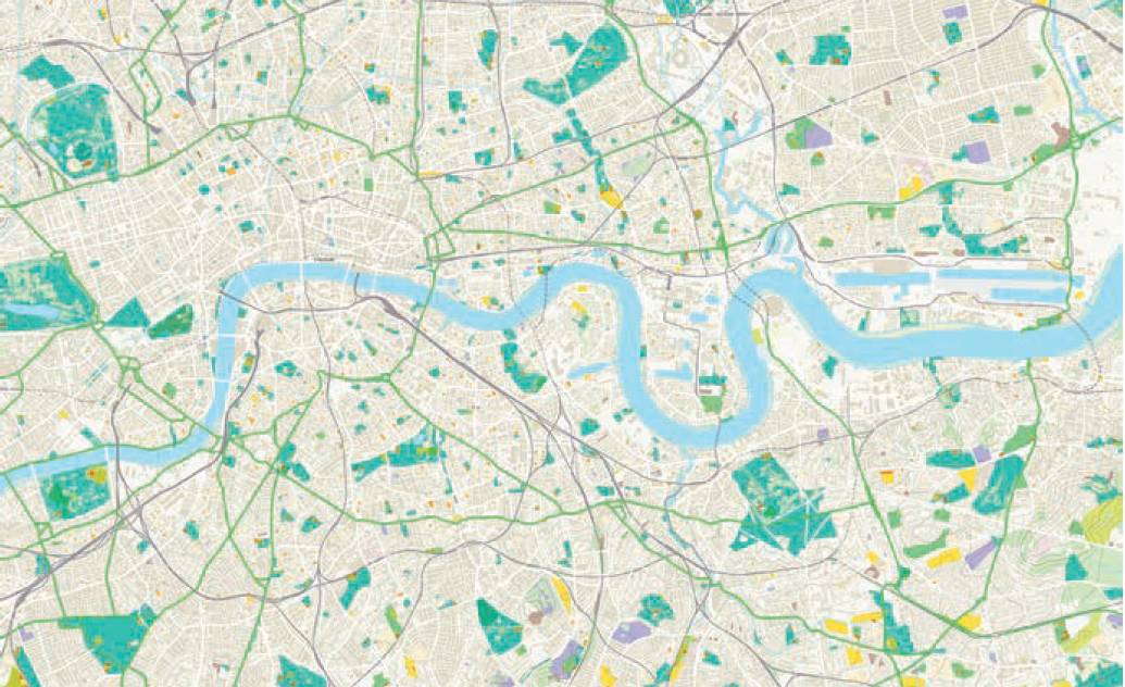
Meeting the demands of such a diverse customer base requires an organisation like OS. With layers of data, we serve as the invisible fabric of the nation. Our data encompasses environmental and landscape features that are crucial for various applications, from consumer use to government and business needs. The users are diverse, but the offer isn’t. It’s about delivering answers and insight through our data. With walkers, that could be where to start and end the walk (with a pub stop!), while businesses and government might want to know about land use and where to build with proximity to local amenities. Most people know Ordnance Survey for our beautiful paper maps, and we do still produce them. But over the past 25 years, the world has gone digital and so have we.
Today, we’ve taken all the location information on those maps, added yet more data and made it all available digitally. This means we now provide the most comprehensive digital representation of Britain – with 500 million location features. There are indeed challenges in catering to a wide range of customers. However, our digital mapping solutions and extensive data allow us to serve this diverse customer base effectively.
In fact, we estimate that every UK adult interacts with our data 42 times each day across various applications, including apps on phones, home utilities, deliveries, broadband and insurance. This location data acts as an unseen fabric that truly matters, connecting people to places. Knowing where things are is a necessity, whether for an outdoor hiker navigating rocky terrain or the emergency services responding to a critical incident.