THE POWER OF THREE
The strategic planning of the A30 Costain/Jacobs JV survey portfolio was crucial to the project’s success, particularly in overcoming the dual challenges of the COVID pandemic and Cornwall’s unpredictable weather
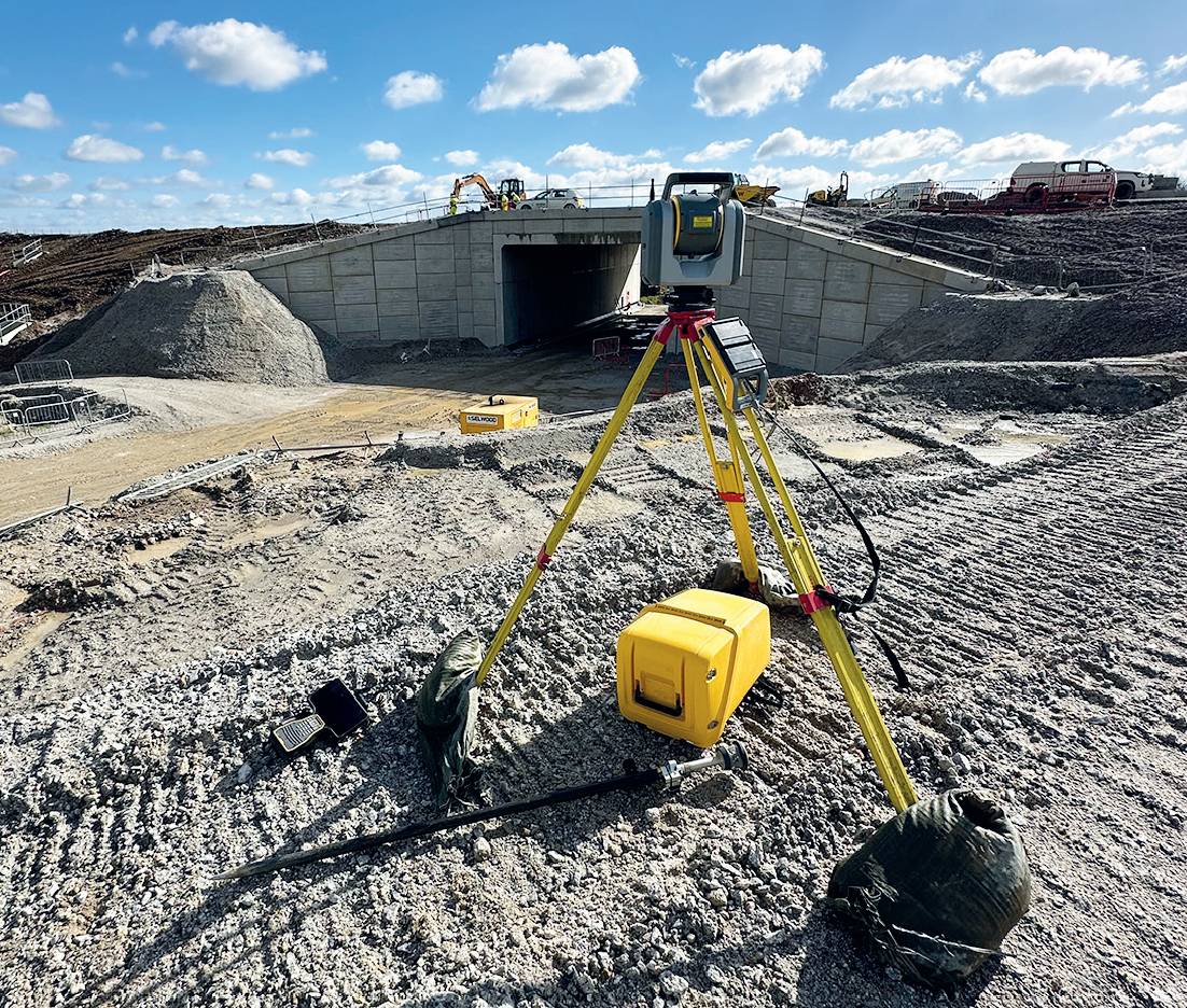
Trimble SX10 scanning total station.
From 2020 to 2024, Costain, in a joint venture with Jacobs, completed the £330m A30 dual carriageway project between Chiverton and Carland Cross for National Highways. This critical upgrade significantly reduces congestion on this section of the A30, where travel times were previously up to four times longer than on other sections, impacting residents, tourists and the Cornish economy.
The project involved building 8.7 miles of dual carriageway, removing the last single-lane stretch of the A30 between Camborne and the M5 at Exeter.
Responsible for the survey work, along with David Warren, senior engineering survey manager for Costain, was engineering survey manager, Jamie Lewis.
A survey team of seven and 13 site engineers were assembled for the efficient delivery of the survey work and in particular the control and setting out for the scheme.
The first challenge faced was how to ensure that good communication was maintained during the project’s initial stages when COVID restrictions still applied. Faced with the task of ensuring all stakeholders (including the client, all home-based teams and affected landowners) had a clear vision of how the site would look, it was clear that images of set out pegs simply wouldn’t deliver.
Safe surveying.
To navigate this, Trimble SiteVision – an advanced augmented reality (AR) tool that overlays precise 3D digital models onto real-world sites – was deployed.
The first challenge faced was how to ensure that good communication was maintained during the project’s initial stages when COVID restrictions still applied.
Working in conjunction with Trimble Catalyst’s centimetre-precision GPS, SiteVision enables the project’s stakeholders to visualise and interact with data on location with 50mm accuracy.
Using SiteVision it was easy to let people on the site visualise how the design would take shape and showcase how the system is used to capture and store data from the field that could be accessed remotely for review or posted on social media for reference by the local community.
This was key to smoothing communication during the early stages of the project when it was just a green field site. It’s an extremely visual tool and one that enabled the survey teams to stay informed and also post information on select social media to allow the local community to comment and track progress.
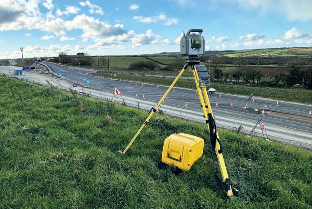
One of the obvious challenges that the Costain survey team faced was how to work safely and effectively alongside live traffic when gathering data for the design team, especially when requests for traffic management were taking the council around a month to process.
One of the obvious challenges that the Costain survey team faced was how to work safely and effectively alongside live traffic when gathering data for the design team, especially when requests for traffic management were taking the council around a month to process.
By using the SX10, the team’s exposure to any traffic was minimised by setting up safely on verges and still capturing the extremely rich topographical detail needed for the design team. In effect, it allowed survey ‘on demand’ with the flexibility to complete three or four surveys on each site visit.
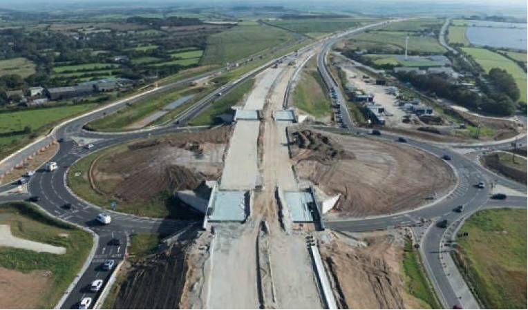
Progress shot of the A30 scheme.
In the latter stages of the project, the team worked through an unprecedented 14 Met Office-classified storms to ensure the road’s opening in June 2024. This perseverance was aided by the rain-resistant Trimble S5 total station (IP65) and the time savings provided by the R12i GNSS.
The survey’s team’s exposure to any traffic was minimised by setting up safely on verges and still capturing the extremely rich topographical detail needed for the design team.
The R12i supported various tasks, including establishing ground control points for aerial progress reporting, conducting general survey work such as site clearance and the setting out of temporary fences and during the later stages, the recording of curb lines and columns.
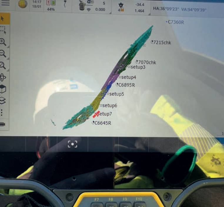
Scan data from the Trimble SX10.
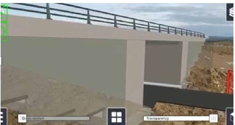
Trimble SiteVision was key to the project’s early stages.
Specifically for this project, the R12i was also instrumental in setting out Cornish hedges along the new route which were built using traditional, sustainable methods and locally quarried slate. The R12i’s TIP technology captures data points without needing to level the pole and, together with the ProPoint technology delivering in challenging GNSS environments, this enabled the survey team to save valuable time.
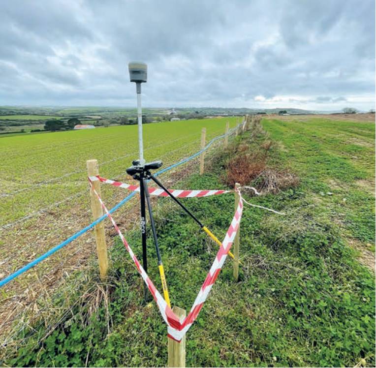
Control work was undertaken with the Trimble R12i.
Together, these features reduced clearance survey time by up to three hours a day compared to using a total station.
Following the scheme’s completion in June, the survey team acknowledged the reliability of the instruments in helping to achieve this milestone.
The Trimble base station, which provided corrections across the site for all equipment, operated flawlessly throughout the entire four-year project.
The performance of the total stations, even in the wettest weather, was also noted.
It’s difficult to say what has contributed most to the project out of the SiteVision, SX10 and R12i, but it has already been decided that without doubt the next road scheme will include all three.
The key numbers from Costain
8.7 miles of new dual carriageway.
The project achieved over 4.5 million hours worked without a RIDDOR incident.
The scheme has achieved a minimum of 20% biodiversity net gain.