
THE CRITICAL IMPORTANCE OF UNDERGROUND MAPPING
Underground utility mapping with smartphones and Gaussian splatting
As cities become denser and infrastructure grows ever more complex, accurately mapping underground utilities is emerging as a critical engineering challenge. According to the American Society of Civil Engineers (ASCE)1, ageing underground pipelines and cables contribute to high maintenance costs and frequent service disruptions in many urban centres. Meanwhile, aerial data collection can be restricted by airspace, towering buildings and the volume of above-ground obstacles. This can result in gaps in data, incomplete visualisations and uncertainty about the exact state and location of buried infrastructure.
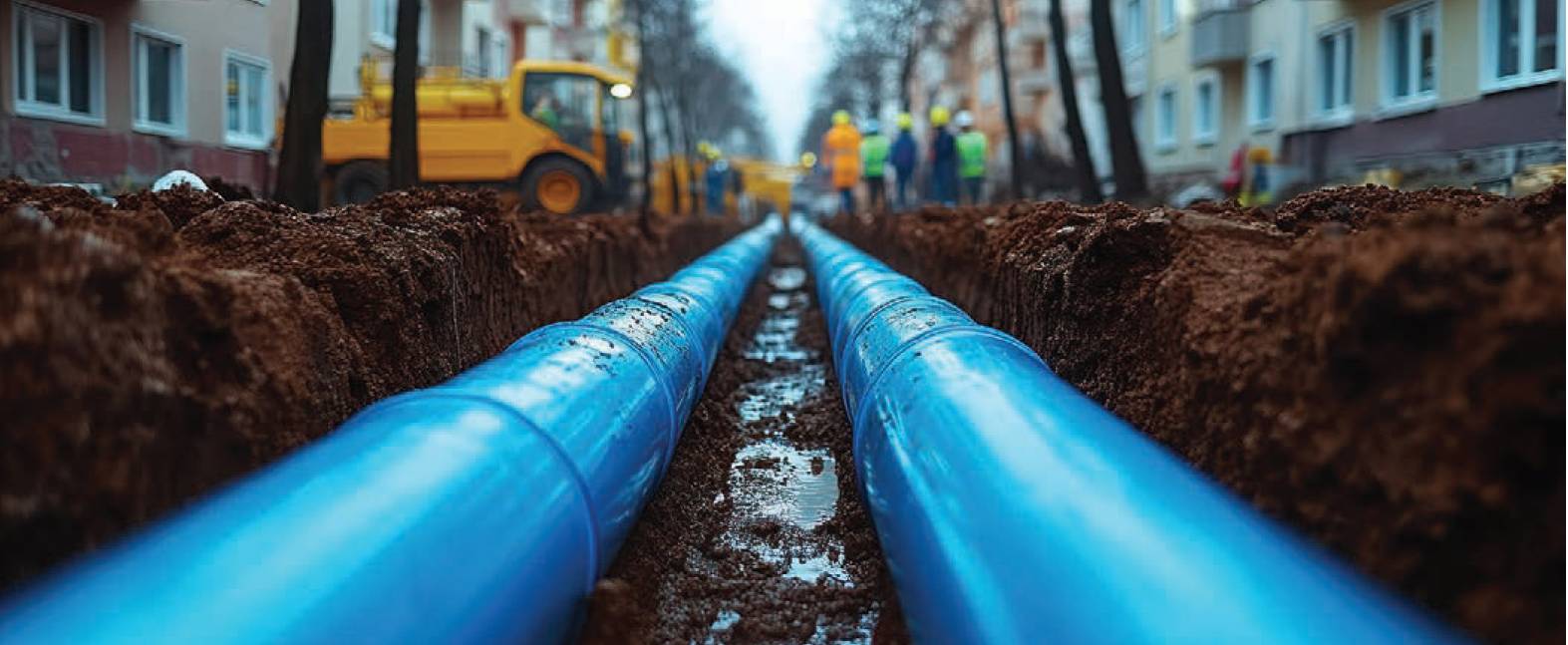
Beneath the surface lies a complex network of utilities, highlighting the need for precise documentation and maintenance in urban areas.
Beyond the technical challenges of data collection, the lack of precise geolocation for underground utilities poses serious safety risks. Utility networks function as an invisible map beneath cities, but without accurate documentation, their locations remain uncertain. When maintenance or new installations are required, utility owners and contractors face hazards. Accidentally striking an unmarked cable or pipeline can lead to severe consequences, including major service disruptions, accidents and even fatalities.
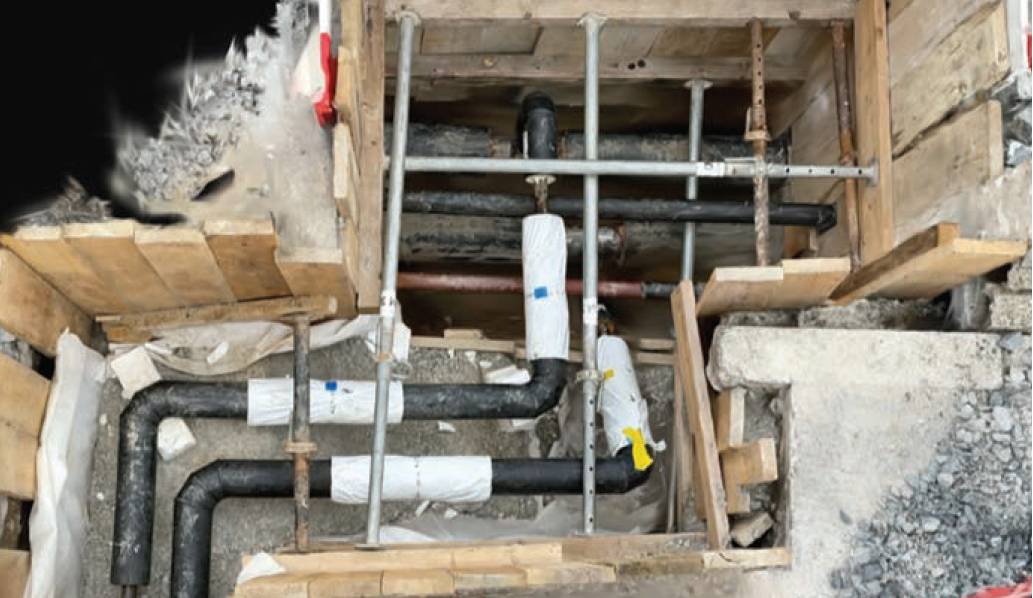
Trench dataset with Gaussian splatting.
Historically, traditional surveying methods have been used to measure underground utilities. This process typically involves hiring a land surveyor on demand to measure pipe locations while trenches are open. However, this approach presents multiple challenges. The necessity of scheduling surveyors at precisely the right time can delay projects and the method itself is inherently limited. Most surveyors rely on GNSS rovers, which require the use of offsets since they cannot enter trenches due to safety regulations.
This results in approximations rather than exact measurements. Additionally, surveyors must work quickly before trenches are closed, increasing the risk of missing critical data points. GNSS rovers can only capture individual points and lines, which do not fully represent the true complexity of buried infrastructure.
Smartphone-based scanning tools present an alternative method for capturing ground-level data, which is also particularly useful in areas with drone operation restrictions. Recent advancements in 3D reconstruction techniques, such as Gaussian splatting, offer new ways to visualise this data.
Gaussian splatting is a rendering approach that represents scenes using numerous overlapping soft, semi-transparent ‘splats’ (Gaussians) that blend smoothly to recreate surfaces, enabling the creation of highly detailed and photorealistic 3D models.
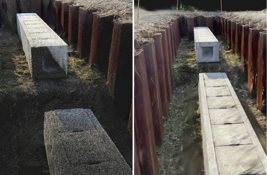
Point cloud (left) and Gaussian splatting (right) in Pix4Dcloud.
Unlike traditional photogrammetry, which can struggle to fully reconstruct complex environments from captured images, Gaussian splatting enables a more comprehensive representation of the scene, ensuring that pipes, conduits, soil conditions and surrounding structures are recorded with clarity.
The detailed reconstruction serves as a clear visual record of the trench at the moment of excavation, aiding documentation and potentially mitigating future disputes. Engineers and field crews can now capture this detailed imagery from a smartphone or tablet.
Smartphone 3D scanning paired with georeferencing methods, such as real-time kinematic (RTK) positioning or ground control points (GCPs), enables models to be aligned with real-world coordinates at a high level of spatial accuracy. This approach supports survey-grade documentation, which is especially useful in dense urban environments where minor positional errors can lead to costly mistakes or service disruptions.
By integrating RTK data, field teams can ensure accuracy in their digital reconstructions, making it easier to cross-reference trench models with GIS databases, CAD drawings and existing utility maps. For instance, the Pix4Dcatch application enables users to generate georeferenced Gaussian splatting outputs from a mobile device.
Georeferenced Gaussian splatting serves as a valuable tool for utility engineers, facilitating reliable documentation for planning and maintenance tasks such as capturing new utility installations, assessing trench conditions prior to backfilling or reviewing excavation damage.
The integration of this technique with accessible technologies like smartphone-based scanning represents a significant advancement in utility mapping.
1 infrastructurereportcard.org