
MAPPING THE FUTURE
The impact of PAS128:2022 and PUMA accreditation
Beneath our streets lies an intricate network of pipes, cables and conduits that deliver vital services essential to everyday life. In the UK alone, this underground infrastructure extends to more than four million kilometres, making precise detection, verification and mapping critical tasks for civil engineering surveyors. The latest revision of the PAS128 specification – PAS128:2022 – provides updated guidelines designed to significantly enhance the management and protection of these crucial assets. Coupled with The Survey Association’s (TSA) groundbreaking PAS128 Utility Mapping Accreditation (PUMA) scheme, surveyors and their clients now have clearer, more robust methods for safely navigating the complexities of underground utilities.
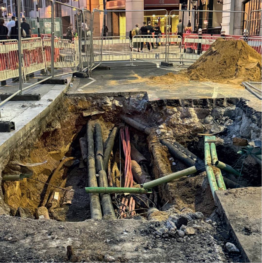
Underground utilities.
Accurate underground utility mapping directly impacts public safety, economic efficiency and environmental sustainability. Each year, the UK economy suffers billions of pounds in losses due to construction delays and disruptions caused by utility strikes and unnecessary excavation. London alone experiences annual economic losses exceeding £750m due to such disruptions. Poorly mapped utilities not only inflate project costs but also pose serious safety hazards to workers and the public.
Each year, the UK economy suffers billions of pounds in losses due to construction delays and disruptions caused by utility strikes and unnecessary excavation.
PAS128:2022 directly addresses these challenges by setting rigorous standards for locating and verifying underground utilities. By adhering to these standards, construction and infrastructure projects reduce the risk of costly delays and accidents, improve worker safety and achieve more predictable outcomes. Additionally, precise mapping facilitates better decision-making, leading to smarter urban planning, reduced environmental impact and improved asset management across various sectors.
The introduction of the National Underground Asset Register (NUAR) further underscores the importance of accurate utility mapping. NUAR is a comprehensive digital platform designed to integrate data on underground assets across the UK. By centralising information from numerous asset owners and utilities, NUAR aims to reduce accidental utility strikes, improve construction safety and facilitate more efficient planning and development processes. Its implementation represents a significant step towards a unified approach to underground utility management, complementing PAS128 standards and helping stakeholders make informed decisions based on reliable data.
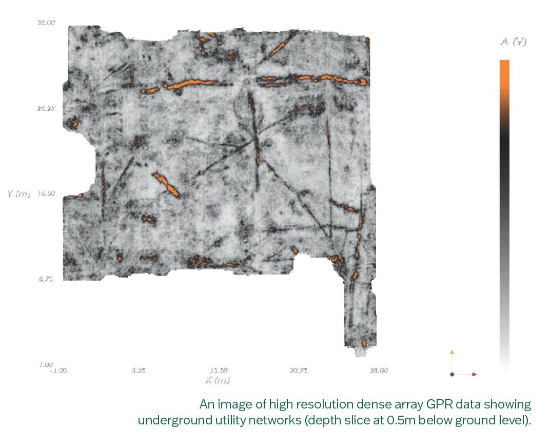
The 2022 revision of PAS128 reflects extensive technological advancements and incorporates valuable industry feedback. A core improvement is the enhanced clarity surrounding survey methodologies, particularly the requirements for using ground penetrating radar (GPR) and electromagnetic location (EML).
The introduction of the National Underground Asset Register (NUAR) further underscores the importance of accurate utility mapping.
The specification now mandates post-processing of GPR data in densely serviced areas, significantly boosting the accuracy and reliability of survey results in urban settings. Further advances include explicit guidelines on practitioner training and required qualifications, ensuring surveyors possess the necessary expertise to conduct accurate and reliable surveys.
PAS128:2022 also mandates the creation of robust digital audit trails and comprehensive reporting protocols, compatible with NUAR’s objectives. These enhancements offer greater transparency and traceability, making it easier for clients to verify survey accuracy, improving trust and facilitating effective project management.
PAS128:2022 emphasises collaborative working relationships between clients and survey practitioners, promoting transparency and clear communication from the outset of a project.
PAS128:2022 emphasises collaborative working relationships between clients and survey practitioners, promoting transparency and clear communication from the outset of a project. It provides detailed guidelines for pre-survey meetings, clear definition of project scope and robust management processes throughout the project lifecycle.
Effective collaboration reduces misunderstandings, ensures the alignment of goals and promotes efficient resource use. The integration of PAS128 standards with NUAR further enhances project management capabilities by providing comprehensive, accurate and accessible utility data. Detailed planning and access to consolidated information via
NUAR help identify potential risks early, ensuring timely resolution and minimising disruptions. By establishing clear expectations and promoting open dialogue supported by reliable data, PAS128:2022 fosters stronger relationships between clients and surveyors, leading to more efficient, effective and successful utility mapping projects.
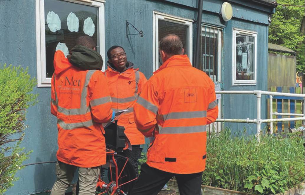
Recognising the specialist skills required for accurate utility mapping, The Survey Association has introduced the PAS128 Utility Mapping Accreditation (PUMA) scheme. Managed independently by LRQA, this rigorous accreditation process validates survey practitioners’ compliance with the PAS128 standard. Achieving PUMA accreditation signals a surveyor’s commitment to excellence, professional growth and adherence to best practice standards.
PUMA-accredited practitioners must meet stringent criteria, including maintaining qualified staff, ensuring continuous professional development (CPD), robust health and safety policies and effective environmental management systems.
PUMA-accredited practitioners must meet stringent criteria, including maintaining qualified staff, ensuring continuous professional development (CPD), robust health and safety policies and effective environmental management systems. Accreditation provides clients with assurance that survey data is accurate, reliable and meets the highest professional standards. As a result, clients benefit from reduced risk, fewer unexpected costs and enhanced confidence in the survey results used to inform critical project decisions.
Clients benefit from reduced risk, fewer unexpected costs and enhanced confidence in the survey results used to inform critical project decisions.
The revised PAS128:2022 specification, reinforced by the robust standards of the PUMA accreditation and combined with the intriguing potential for integration of real-time utility mapping data with the online NUAR platform (which we can imagine might happen at some point in the future), could represent a transformative step forward in utility mapping practices.
While compliance with PAS128:2022 and PUMA accreditation ensures regulatory adherence, the benefits extend significantly further. Accredited practitioners leverage their expertise to advise clients on the most appropriate survey methods, optimal timing and effective budget management. Their proactive insights help prevent project delays, manage risk effectively and maximise project efficiency.
Additionally, the heightened transparency and accountability resulting from adherence to PAS128 standards and PUMA accreditation foster greater trust between clients and survey practitioners. This trust not only enhances collaboration but also leads to long-term relationships built on mutual respect and shared goals, significantly contributing to the success and reputation of both clients and surveying organisations.
The revised PAS128:2022 specification, reinforced by the robust standards of the PUMA accreditation and combined with the intriguing potential for integration of real-time utility mapping data with the online NUAR platform (which we can imagine might happen at some point in the future), could represent a transformative step forward in utility mapping practices. These developments reflect not merely incremental improvements but a substantial shift towards greater precision, accountability and professional excellence within the surveying industry.
By embracing PAS128:2022, PUMA accreditation and the implementation of NUAR, the industry can be better equipped to handle the complex challenges posed by underground infrastructure. This comprehensive approach will not only mitigate immediate risks but also support long-term sustainable development, ensuring a safer, smarter and economically efficient future for the UK’s infrastructure.
Sam Roberts is a member of the CICES Utilities and Subsurface Mapping Panel and chair of the Yorkshire region.
Read the CICES Client Guide on Specifying a PAS128:2022 Utility Mapping Survey here: https://www.cices.org/publications/pas128-guidance
For more information about PAS128 – access the recently published TSA Client Guide To PAS128:2022 here: https://www.tsa-uk.org.uk/resources/downloads/resources-download/
Find out more about PUMA accreditation here: https://www.lrqa.com/en-gb/utilities/tsa-pumascheme/