Peatland restoration
Lucy Hamilton, KOREC Group
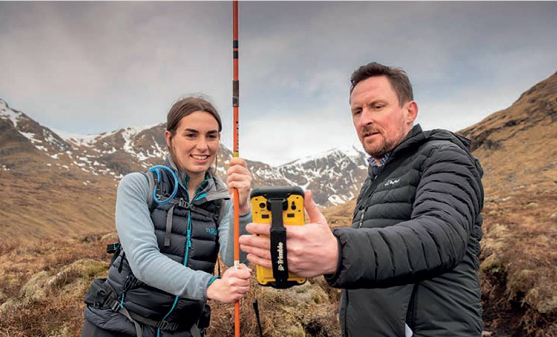
Recording attribute information with the Trimble TDC600 and KOREC’s K-Capture software. Angus Davidson and Kirsty Hedderwick visit one of their peatland restoration sites on the Fannich Estate between Garve and Achnasheen.
PEATLANDS are a key part of the Scottish landscape and account for over 20% of the country’s land mass. However, 80% of Scotland’s peatlands are degraded in some way. Instead of capturing carbon from the atmosphere, giving them a vital role in the fight against climate change, a degraded peatland can emit more CO2 than it removes. Encouragingly, regeneration is already underway with the Scottish Government’s climate change plan citing an aim to restore at least 250,000 hectares by 2030.
As well as helping the climate, restoring peatlands to good condition generates carbon credits which the private sector can invest in for offsetting. The Peatland Code Registry shows suitable projects for these investors and project developer details to facilitate sales.
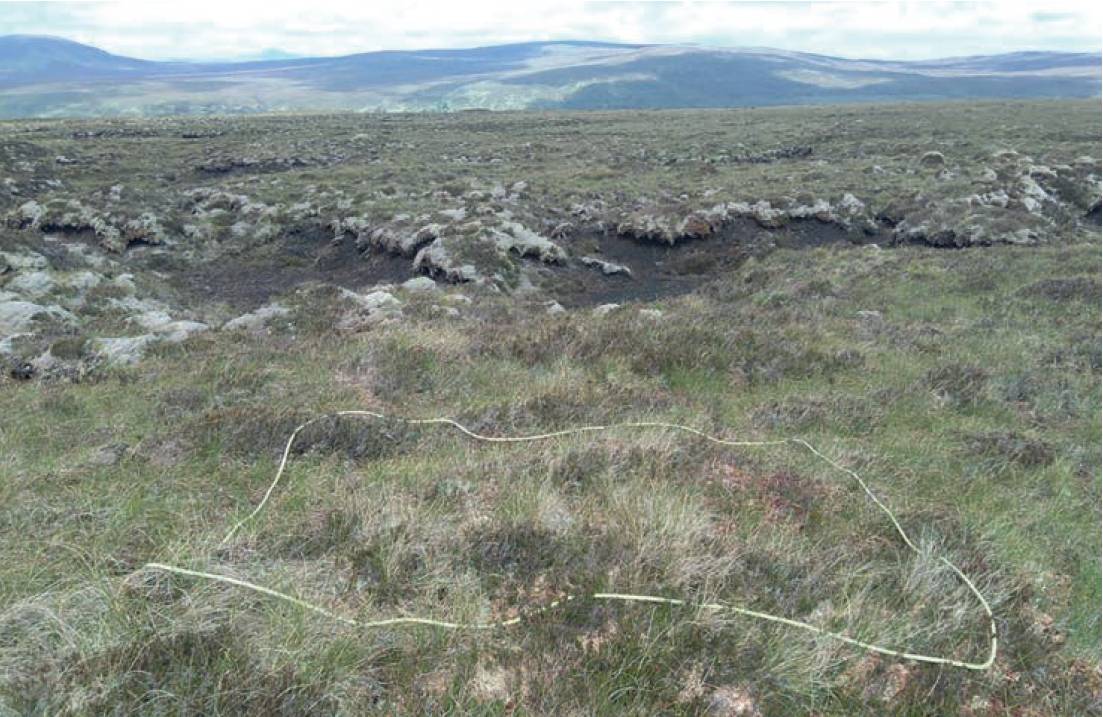
Points are placed every 100m across the peatland and navigated back to regularly assess restoration progress.
For Angus Davidson Ltd (ADL) rural consultants and specialists in peatland restoration, cloud networking has been key to the management of its field data capture workflow as the company tackles the vast amount of data collection required for its successful remediation work. ADL currently have 21 peatland projects on the UK Land Carbon Registry making it the largest project developers in the UK. With a further 20 projects being developed and an increasing demand for its services, it is on an exciting journey whilst restoring degraded habitats at scale in the process. However, for the Peatland Code Registry to operate effectively, it must have extensive data on which peatlands are being restored, how large the areas are and how effective the restoration process is at any point in time.
Specialising in supplying this data, ADL supports businesses the length and breadth of Scotland with its detailed knowledge of the rural landscape. In particular, unlike carbon brokers, ADL offers peatland regeneration with services including feasibility, funding, tendering, mapping, monitoring and field work. Central to this work is having accurate positional data for each peatland project along with the attendant photographs and attribute information.
Vast rural areas and a cloud-based workflow
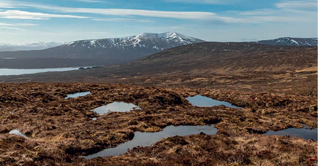
Peatland restoration sites on the Fannich Estate between Garve and Achnasheen. Here, restored peatland with pools- a sign of a healthy peatland.
It’s almost impossible to envisage the scope of a peatland estate wide mapping project with some of the larger ones having perimeters of 70km, covering 11.5k hectares and requiring more than 4,500 points to be navigated to, recorded and photographed.
For company owner, Angus Davidson, the specifics of this type of project dictated that he would have to reconsider how best to equip environmentalists in the field.
He quickly realised that the company’s existing handheld mapping loggers would not be able to reliably handle both the quantity of the data and the quality of the images required.
Key requirements for a replacement system included:
- Handheld logger with an accuracy of more than 2m with the option to link to a GNSS receiver if ever cm accuracy was required.
- A lightweight, resilient and portable system – the team could typically walk 25-plus km during a day in challenging weather conditions.
- Long battery life – perfect for all day in the field.
- Lone worker tracking via a web portal for safety in vast open spaces.
- Ability to toggle between two background maps – OS MasterMap and aerial data – this would allow the field worker to navigate to points but also be aware of watercourses etcetera for health and safety reasons.
- Geo-referenced images – each point requires a geo-referenced photo for use later.
- Ability to share captured data, live, through a web-based portal.
Following a consultation with KOREC Group, ADL purchased six Trimble TDC600 all-in-one GNSS smartphone/data collector. These have a 1.5m accuracy, with each running KOREC’s K-Capture on-board data capture software. Two Trimble subscription-based Catalyst GNSS receivers were also purchased for use in cm accuracy work as required. In addition, the team purchased a KOREC-supplied web-based portal for managing the team and the data.
It’s almost impossible to envisage the scope of a peatland estate-wide mapping project with some of the larger ones having perimeters of 70km, covering 11.5k hectares and requiring more than 4,500 points to be navigated to, recorded and photographed.
Cloud networking for managing data and creating a team
The K-Portal was used for team management and also gave the team the ability to share captured data as it was web-based. In the field, it enabled the team to:
- Carry out a desktop assessment of the potential peatland areas using aerial imagery.
- Define the area to be mapped.
- Plot points at 100m intervals for navigation purposes.
- Carry out fieldwork with live sharing of collected data, such as depth and condition, to the web-based K-Portal.
- View data in the portal and monitor peatland regeneration by revisiting the same points at later dates.
Typically, an initial data collection project can take place over a number of days with several field workers capturing points at the same time. It’s therefore vital that the data they collect is immediately available for viewing on both the K-Portal and via the TDC600 loggers. This ensures that each worker’s progress and safety can be tracked and that there is no overlap of work. In the field, easy to use drop-down menus ensure that all collected information is in a standard format and every member of the team knows where the others are working.
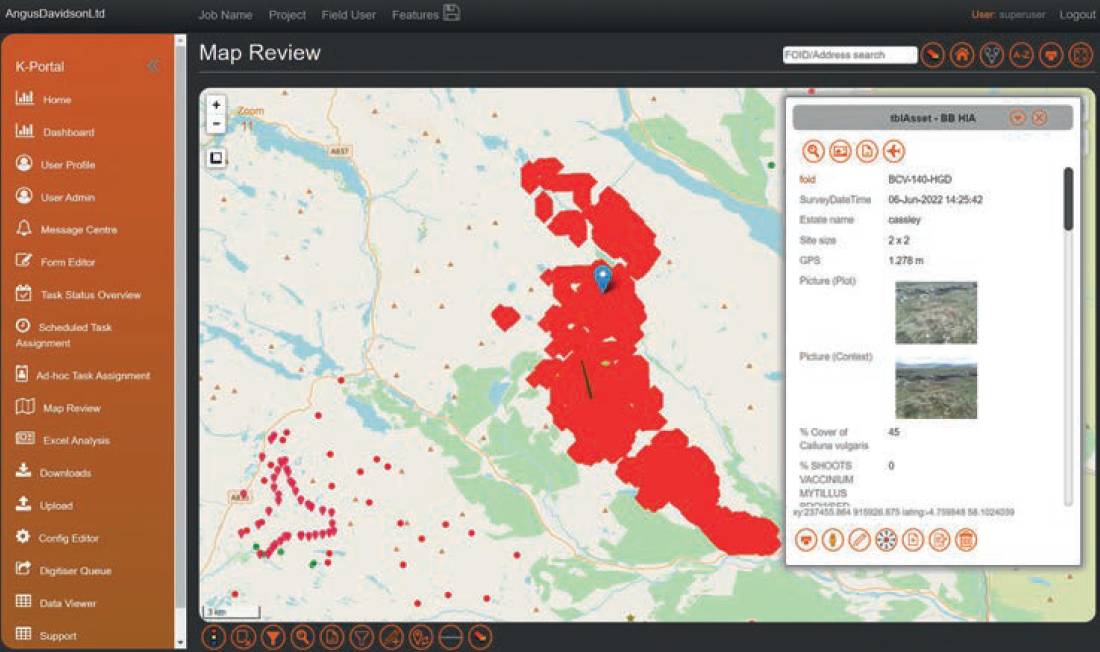
Data and attendant peatland images shown in the KOREC Portal. Projects such as this can include 4,500 points and pictures.
Back in the office the portal ensures that there is no double handling of data or wasted time manually uploading points and images. Work can therefore begin on using that data for the preparation of peatland code registration, funding etcetera, immediately. The portal can also be used for viewing a history of each point as it is revisited to check on the effectiveness of the restoration program and provide visual evidence of successful treatment. For ADL, the ability to use cloud networking improved workflow and allowed it to take on and handle several large peatland restoration projects at once. As it develops the new workflow, the next aim is to increase the ways in which it can share both this data and other environmental project work with relevant stakeholders and clients through use of the portal.
Lucy Hamilton, KOREC Group
All photos ©Angus Davidson.