New kit on the block
Eloise McMinn Mitchell, Pix4d
Numerous case studies have shown its real-time use in multiple locations, for a variety of projects and industries, including construction, site surveying, and accident reconstruction.
FOR professionals, any new tool or method can be as disruptive as it can be revolutionary.
In the construction sector, new equipment that provides greater measurement accuracy will see few benefits if it takes hours to set up, or requires long periods where work has to stopped in the meantime.
The main challenge for surveyors is deciding if the tool brings enough benefits without drastically changing or inconveniencing existing surveying workflows.
The viDoc real-time kinematic (RTK) rover, a handheld device that connects to the latest iPhones and iPads, assists in bringing RTK accuracy to terrestrial photogrammetry and lidar data collection.
Designed in Germany by viGram and distributed by Pix4D, the terrestrial surveying workflow that has been created has been certified approved for use across Europe, North America, and specified parts of Asia.
How does it work?
The rover works by recording RTK data while connected to the mobile application PIX4Dcatch. The app captures both photo and lidar data from the phone while connected to an Networked Transport of RTCM via Internet Protocol (NTRIP) network.
The device is attached to the mobile phone or tablet and records data alongside the app. This data can then be exported to the Pix4D software suite, either to PIX4Dcloud, PIX4Dmatic, or PIX4Dmapper.
The user will then have access to a 3D point cloud of the site with RTK accuracy to within a centimetre.
Numerous case studies have shown its real-time use in multiple locations, for a variety of projects and industries, including construction, site surveying, and accident reconstruction.
At work for pipe laying in Singapore
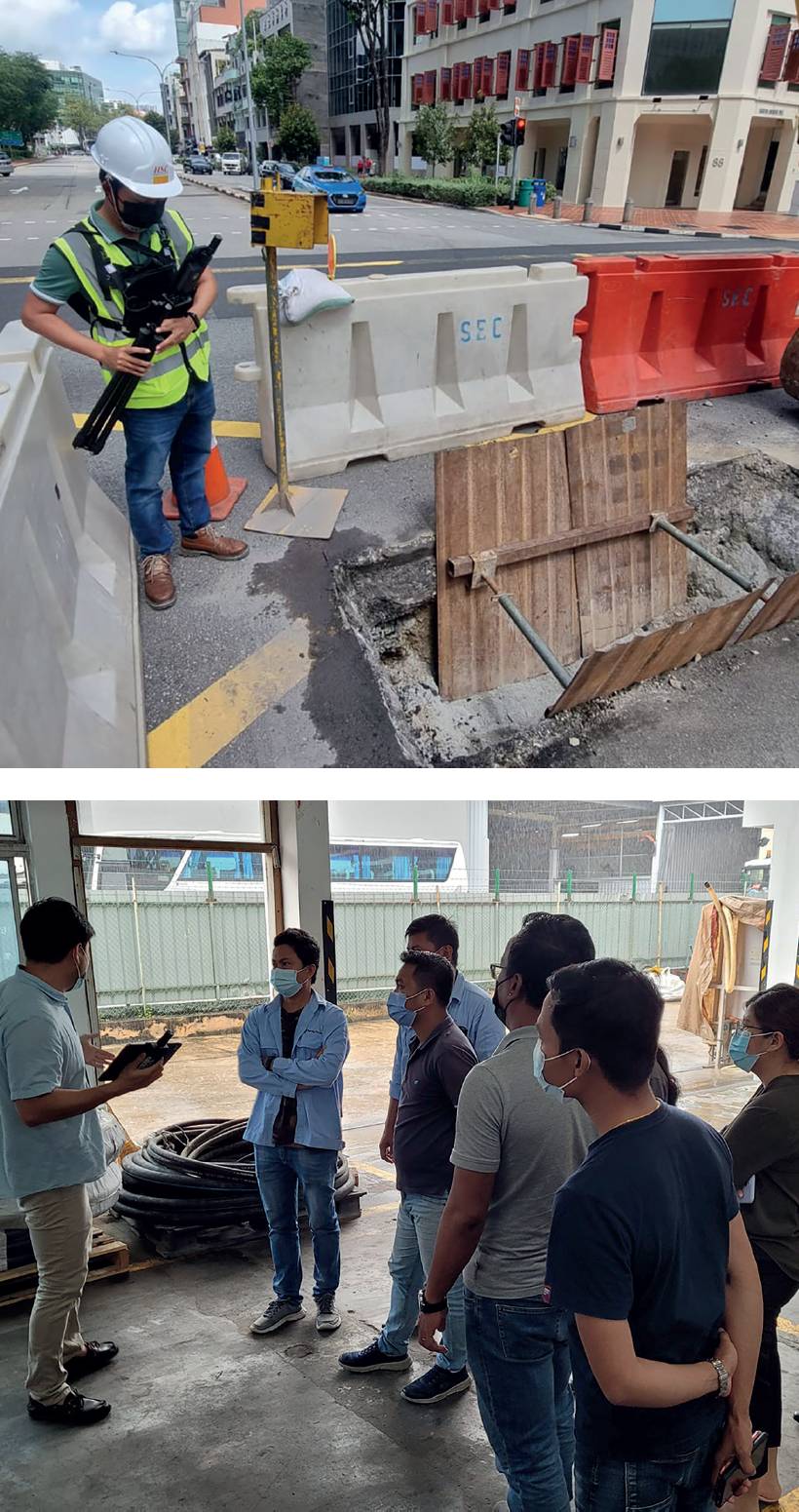
Above and below: Lidar site scanning using the viDoc RTK rover in Singapore.
HSC Pipeline Engineering is a specialised company that has operated in Singapore for 29 years. Their work experience includes pipeline and related engineering services for gas, water, and telecommunications.
Working in Singapore presents multiple challenges, not least of which is the high degree of urbanisation and population density. Construction work in the city can affect traffic, utility operations, and local residents.
This means HSC needs to minimise disruptions without compromising the safety or quality of its work.
One of HSC’s key operations is the excavation of trial holes for surveying before pipe laying. These typically require five to 10 people to dig, measure, and backfill the holes. They are dug at 30m intervals when laying underground utilities. The work with these trial holes makes up 10% of HSC’s excavations across Singapore.
As HSC lays upwards of 3,000 metres of pipes per month, the operational commitment of trial holes is 67,200 hours of work per year and costs $1,800,000.
It conducted a pilot with the rover to establish if it could speed up operations by digitally reproducing excavated trenches and share the outputs with stakeholders for inspection, reviews, and any necessary further analysis.
HSC tested the rover and paired it with the cloud-based photogrammetry software PIX4Dcloud for processing.
PIX4Dcloud processes datasets online. It negates the need for processing hardware in the field, making it useful for construction or on-site work that needs to be lightweight and agile.
The aim of using the viDoc was to scan a trial hole that was part of surveying efforts at a busy road. Construction work in Singapore requires multiple permits and licenses, so deploying the viDoc could not slow down ongoing time-sensitive operations.
The site survey worked as follows:
- The viDoc was attached to an iPhone 12 Pro Max and connected to an NTRIP network.
- One person holding the device moved around the site with the PIX4Dcatch app open. The app has an in-screen mesh that tells users how complete data collection is, or if there are any areas of the site that need more data capture.
- The site scan only took five minutes to complete. Work resumed afterward.
- The surveyor uploaded the data capture results directly to PIX4Dcloud from the iPhone for processing.
- Processing was completed within an hour. The final output from PIX4Dcloud was a 3D point cloud with RTK accuracy that can be annotated, measured, and shared with contractors, regulators, and any other stakeholders.
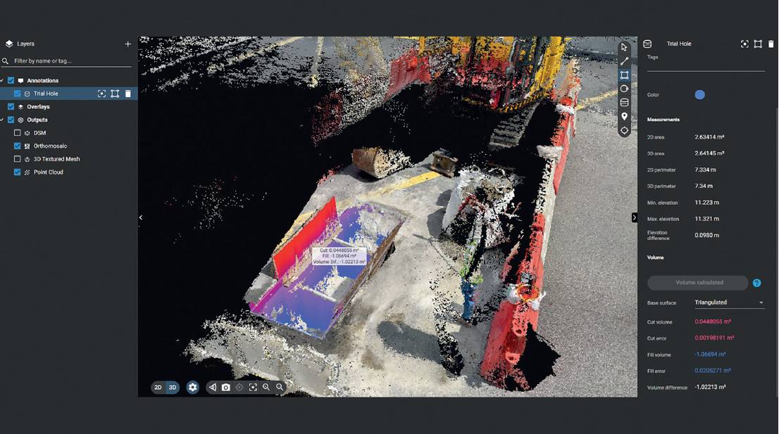
The resulting digital twin created meant that unnecessary site visits could be eliminated, allowing for better communication between project contractors, and proof of following site rules that could be shared with regulators.
It saw HSC roll out the viDoc to multiple sites.
Bridge restoration with a joint lidar and photogrammetry workflow
For professionals, any new tool or method can be as disruptive as it can be revolutionary.
Atay, working in Turkey, specialises in surveying for mining, agriculture, and infrastructure management.
It has been involved in inspection and surveying work across Ankara, where there is a city-wide effort to restore historic structures to preserve the cultural heritage.
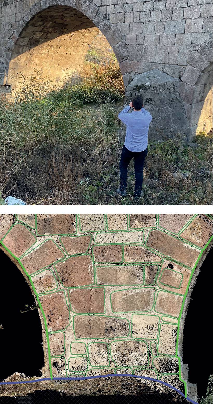
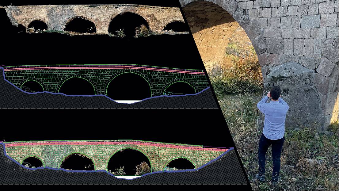
Above and below: Lidar site scanning using the viDoc RTK rover in Turkey.
Atay was hired to survey a bridge on the outskirts of the city that had historic significance. The task was to inspect it and share outputs with the relevant authorities to determine what maintenance or restoration work would be needed.
Atay decided to use the viDoc RTK rover for this project, with the intention of using the handheld scanner rather than a drone for an aerial photogrammetry survey.
The rover would provide access to lower angles of the bridge that could not easily be accessed with a drone. It also wanted to utilise the lidar data alongside photogrammetry outputs.
Site awareness is critical to maintaining safety, monitoring progress and sharing information to collaborate with teams.
To do this, Atay decided to use PIX4Dmatic, a desktop photogrammetry solution for analysis in order to process both lidar and photogrammetry datasets captured with PIX4Dcatch.
It allowed surveyors to choose between analysing a depth or a dense point cloud, or using a fused one.
This degree of control over the data would be used to ensure it had a complete 3D model of the bridge.
The outputs would then be exported to PIX4Dsurvey, which could make them ready for computer-aided design (CAD) and vectorisation, which suits workflows for architecture or building information modelling (BIM).
The workflow for this project was similar to the one deployed by HSC, but took longer because it was a larger site:
- Geomatics engineer, Yigit Yuksel went to the bridge, where he connected PIX4Dcatch and the viDoc RTK rover. Yuksel attached the device to a surveying rod to reach hard-to-access parts of the bridge.
- Yuksel scanned the entire site, taking 45 minutes to complete data collection.
- Yuksel then headed back to the office, where they transferred the data to PIX4Dmatic, which began processing.
- After PIX4Dmatic completed processing, Yuksel clicked one button to transfer the outputs to PIX4Dsurvey for vectorisation and further analysis.
The entire workflow generated precise results with a very precise ground sampling distance (GSD) of just 0.2cm. This means that the distance between two pixels on a screen represents 0.2cm, indicating a high degree of accuracy and detail from the dataset.
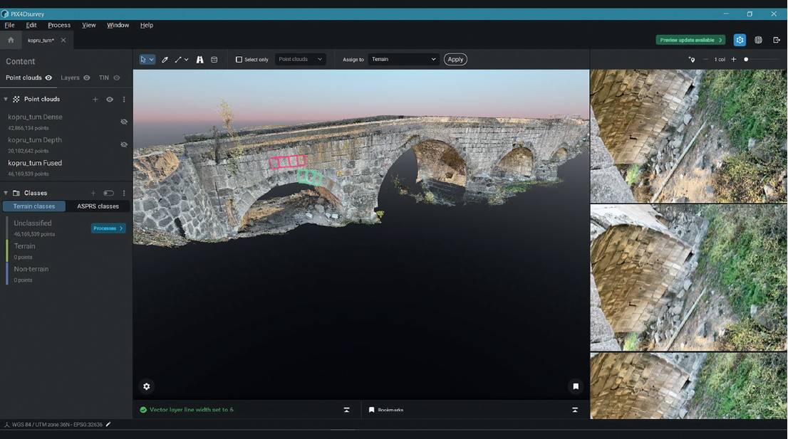
Architects or designers can use this level of detail to complete careful visual inspections of the entire bridge. Processing and data collection took a total of four hours and 15 minutes, meaning they had results ready in less than a day. The viDoc provided accuracy that was used to create a digitised version of the bridge for use in official records.
The future of terrestrial site surveys?
Site awareness is critical to maintaining safety, monitoring progress and sharing information to collaborate with teams. Both of these use cases show that the device can be incorporated into existing workflows with little to no disruption as well as benefits.
Eloise McMinn Mitchell, Pix4d